Sinkhole forms on busy Germiston road, motorists cautioned
Traffic diverted after a pothole expanded into a dangerous sinkhole.
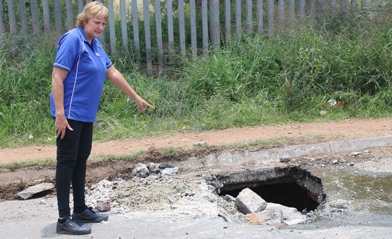
Ward 36 Clr Wendy Morgan has warned residents to exercise caution when driving along Johan Rissik and Main Reef roads due to a developing sinkhole.
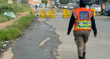
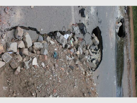
The sinkhole is forming in the Germiston area on Johan Rissik Road, between Junction Road and Main Reef Road, parallel to the Marathon informal settlement. As a safety measure, the two lanes travelling in the same direction have been temporarily converted into a two-way traffic flow.
Motorists are urged to reduce speed, exercise caution, and follow the temporary traffic arrangements when using this route. The Roads Department has been notified and will attend to the matter.
ALSO READ: Sinkhole develops on Johann Rissik Street in Germiston, traffic flow adjusted
Morgan added that the sinkhole began as a pothole that was later repaired, but it continued to expand.
“This January, in addition to a water leak in the area, the road collapsed, forming large holes,” she said.
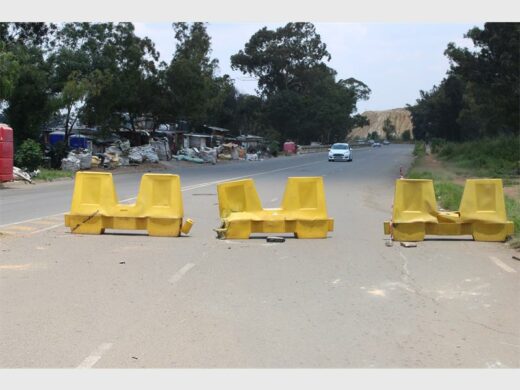
“The roads department was informed, which led to barriers being erected to close the affected lane. However, this has led to increased traffic congestion and chaos during rush hour. Motorists are urged to use alternative routes, and heavy vehicles are advised to avoid the area as their weight could further destabilise the road.”
Morgan further stated that it is suspected the sinkhole may have been caused by a collapsed water pipe or illegal mining activities.
GCN contacted the City of Ekurhuleni’s media team to inquire about the situation. The City responded that this is a non-dolomite-related incident, as the area is non-dolomitic.
The City is seeking clarity from the Department of Mineral Resources (DMR) and the Council for Geoscience (CGS), as mining-related issues fall outside the city’s scope of responsibility.
ALSO READ: WATCH: Woodmere sinkhole repair project nears completion, residents relieved
However, the city commissioned Mshandukani Holdings to conduct a site inspection to determine the severity and possible cause of the problem and to recommend appropriate remedial actions.
The position of the affected area was recorded using a handheld GPS device.
According to Geological Map 2628 (East Rand Geological Series), the area is underlain by quartzite and conglomerate of the Johannesburg Subgroup of the Central Rand Group within the Witwatersrand Supergroup, which is non-dolomitic. The map further indicates that the area is surrounded by both active and inactive mining operations.
As the area is non-dolomitic, there are no dolomite groundwater compartments or groundwater monitoring boreholes located within the site. The groundwater conditions remain unknown.
Assessment of the inspection
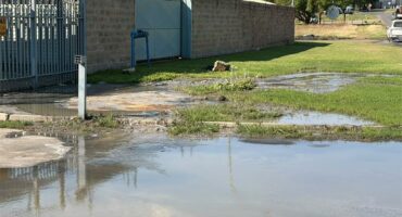
During the visual inspection, openings were observed cutting across the road. The depth and extent of the hole could not be determined; however, it was noted that the opening is extending towards Portion 120 of the farm Elandsfontein 90-IR. Water was observed seeping from the ground surface, where the tar road shows signs of deterioration and spalling.
Residents were observed collecting water for domestic use, as it appeared clean. Rubble was also seen partially backfilling the affected portion of the road. Yellow road barriers have been erected to cordon off the affected area.
ALSO READ: Germiston residents at risk as neglected sinkholes swallow roads
Residents indicated that water has been seeping out for approximately three months, while the openings appeared more recently. According to the City of Ekurhuleni’s wet services database, there are no municipal wet services passing through the affected area. The source of the water remains unclear at this stage.
Historically, sinkholes of a similar nature were reported in April 2025, approximately 120 metres from the current sinkhole location at the Marathon Informal Settlement.
Based on available topographic and geological maps, mining activities surround the area. The sinkhole is therefore most likely mining-related and may be the result of a collapsed mine shaft.
Conclusions and recommendations
The area is non-dolomitic, and dolomite-related instabilities are not anticipated. The observed hole is most likely the result of collapsed mine workings. As mine-related problems fall outside the scope of this office, no direct intervention can be undertaken.
The sinkhole poses a serious and life-threatening danger to motorists and residents. It is therefore recommended that the matter be urgently referred to the CGS and the DMR. Immediate safety measures, including barricading the affected area, should be prioritised pending rehabilitation.
It is also recommended that the Department of Water and Sanitation assess the water source. Should the water originate from a municipal supply, it must be repaired immediately, as water seepage may exacerbate the situation.