Could September bring a wet twist to Gauteng?
Forecasters are monitoring an early September weather setup that could shift dry early-spring conditions toward inland showers.

As South Africa enters the first week of September, weather patterns show potential for significant change.
A weather enthusiast known as the Weather Hooligan told the Krugersdorp News that current extended-range model guidance indicates the potential development of a cut-off low over the western interior and Northern Cape region, while a cold front moves into the country.
He explained that the combination of these two systems could become particularly important for rainfall across South Africa – and could potentially bring rain to Johannesburg and parts of Gauteng. At this stage, however, the setup remains a potential weather scenario rather than a confirmed rainfall event.
Developing system could push rain inland
The approaching cold front is an important part of the setup.
He said as the front pushes into South Africa, it could interact with increasing moisture and the developing upper-air low. If the timing and positioning are favourable, the interaction could increase atmospheric lift and instability, allowing rainfall to spread further inland than would normally be expected from a passing cold front alone.
The potential cut-off low could also slow the overall weather pattern down, allowing moisture and instability to remain over parts of the country for longer.
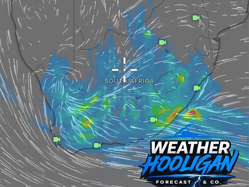
Early September window in focus for Gauteng
For Johannesburg and surrounding parts of Gauteng, the period from Thursday, September 3 to Sunday, September 6 is worth watching.
The potential scenario could see increasing cloud cover, cooler conditions and a chance of rain spreading eastward from the western interior.
He said if the cut-off low shifts further east or the cold front interacts favourably with the upper-air circulation, Johannesburg could potentially find itself under a much wetter setup. The exact rainfall coverage remains uncertain.
“One model solution may keep the heaviest rainfall further west, while another could shift the system eastward and bring considerably more rain into Gauteng.”
He explained that’s the challenge with cut-off lows: a relatively small change in the position of the upper-air low can make a major difference to the rainfall distribution.
“The current signal suggests that the first week of September could begin with a significant change from the warmer and drier conditions normally associated with the end of winter and beginning of spring on the Highveld.”
For Johannesburg, the potential impacts could include:
• Increasing cloud and rainfall potential
• A noticeable change in wind direction
• Cooler temperatures behind the front
• Possible thunderstorms if sufficient instability develops
• Rain potentially spreading further east
• Much colder air across parts of the interior if the upper-air system deepens sufficiently
However, snow is not being forecast for Johannesburg at this stage. The current focus is on the potential for rain and a significant change in the weather pattern.
The big question is whether the cut-off low develops strongly enough and far enough east for its circulation to interact with the cold front and draw moisture towards Gauteng.
If that happens, Johannesburg could see a much wetter start to September.
This is still a developing forecast signal and should not be treated as an official warning. Forecasts can change significantly at this range.