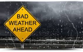
[JUST IN] Severe thunderstorms to be expected in Gauteng
Some of these thunderstorms are expected to become severe during the course of today, 4 October up until the weekend, as they progressively spread east during the remainder of the week.
This morning a cold front moved across the southern and eastern parts of the country, which resulted in windy, rainy and cold conditions in the Western and Northern Cape.
According to the South African Weather Service, it is accompanied by an intense upper trough (extension of a low pressure in the upper portions of the atmosphere) which resulted in a band of thundershowers moving through the western and central parts of the country.
Also Read: Extreme weather conditions expected
Some of these thunderstorms are expected to become severe during the course of today, 4 October up until the weekend, as they progressively spread east during the remainder of the week.
These conditions are expected to spread to the Free State and North West, KwaZulu-Natal, Mpumalanga, Limpopo and Gauteng by tomorrow, 5 October.
The risk for severe thunderstorms for Gauteng and other provinces remains on Saturday, 7 October. It will start warming up on Sunday.
As a result of this expected extreme weather, please take not of the following possible impacts:
• Wet and slippery roads
• Occasional poor visibility
• Strong gusty winds would make for dangerous driving conditions
• Heavy downpours will result in flash flooding in places, which could lead to flooding of some settlements and roads
Precautions to take during flooding:
• If walking outdoors, avoid crossing rivers and swollen streams where water is above your ankles.
• Just 15cm of fast-moving flood water can knock people off their feet, and a depth of 60cm is enough to float a car.
• Never try to walk, swim or drive through fast-moving flood water. Stop, turn around and go another way.
• Listen to the special warnings on radio and/ or television.
• Never drive into water covering the road. You would not know how deep it is or if the road has been washed away.
• If the vehicle stalls, leave it immediately and seek higher ground.
• Be especially cautious at night when it is harder to recognise flood dangers.
The South African Weather Service will continue to monitor further developments during this period and will issue subsequent updates as required. Furthermore, the general public are urged to regularly follow weather forecasts on television and radio. Updated information may also be accessed on www.weathersa.co.za as well as via the South African Weather Service Twitter account @SAWeatherServic.
Figure 1: A composite satellite image indicating the steep upper air trough to the west of South Africa (orange to red colour) at 10am SAST. ©EUMETSAT 2017
Do you perhaps have more information pertaining to this story? Email us at krugersdorpnews@caxton.co.za or phone us on 011 955 1130.
For free daily local news on the West Rand, also visit our sister websites:
Remember to visit our Facebook, Twitter and Instagram pages to let your voice be heard!