
Prepare for another wet and stormy weekend in Newcastle
Newcastle braces for more thundershowers this weekend. Stay safe with essential hail, flood, and storm safety tips. Read more here:

Newcastle residents should brace for another wet and stormy weekend, with an 80% chance of thundershowers predicted for both Saturday and Sunday, November 15-16.
The South African Weather Service has advised that the central and eastern parts of the country are expected to experience a severe weather event over the weekend.
This is due to an intense weather system – a cut-off low-pressure, that is expected to affect the country between Saturday and Monday.
“This type of weather system is often associated with widespread rainfall and severe thunderstorms, which bring a risk of flooding amongst other hazards such as damaging strong winds and hail,” said SAWS.
SAWS urged the public to closely monitor local weather updates and to take the necessary precautions ahead of time.
Saturday:
According to the South African Weather Services Saturday, will see a warm start with clear skies in the morning, turning stormy by late afternoon as showers and thundershowers move in. Expect a noticeable cool-down by evening with light winds shifting southwest.
- Temperatures: 14°C (morning) – 27°C (afternoon)
- Rainfall: 10 mm
- Rain chance: 80%
Sunday:
A cool and wet day ahead with steady rain from morning through evening. Expect slight rain early, turning to moderate showers later in the day.
- Temperatures: 14°C (morning) – 20°C (afternoon)
- Rainfall: 15 mm
- Rain chance: 80 %
Following last weekend’s sudden and unpredictable hail and thunderstorm, we’ve got you covered with a few important dos and don’ts during extreme weather conditions.
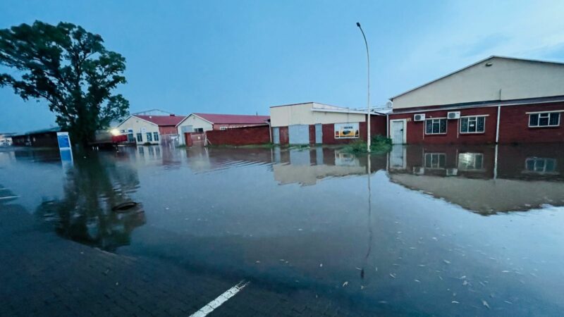
Photo: Newcastle Advertiser
Hail:
- When hail is forecast, try to park your car under cover and delay travelling until the storm has passed.
- If you are caught in a hailstorm, look for shelter such as a covered car park, a petrol station, or under a bridge. Take extreme care when pulling over, switch on your hazard lights, and do not risk your safety or that of others.
- Avoid parking under trees, as falling branches or debris may cause damage. Stay in your car until the storm has passed.
- If no shelter is available, pull over safely. Hail damage is unavoidable in open areas, but it is safer to stop than to drive through poor visibility and slippery roads.
- Keep heavy blankets in your car to use as protective covers for your bonnet and windows.
Thundershowers:
- Increase your following distance by one to two seconds to prevent collisions.
- Drive at or below the speed limit. Remember that roads are most slippery just after it starts to rain.
- Turn on your headlights to be more visible to other motorists.
- Do not overtake when visibility is poor.
- Keep both hands firmly on the steering wheel.
- Stay alert to your surroundings.
- Ensure your windscreen wipers are working properly for a clear view of the road.
Floods:
- If you live in a flood-prone area, keep sandbags handy to place against doorways and vents. Move valuables to higher levels when flooding threatens.
- Regular home maintenance, such as clearing gutters, can greatly reduce flood damage.
- Turn off gas and electricity if flooding occurs.
- Never attempt to drive through floodwaters. As little as 15 cm of moving water can knock you off your feet, and 60 cm can sweep away a vehicle.
- Avoid crossing bridges or roads near rivers during heavy rain. If you are caught in flooding, shift to a low gear and proceed slowly.
- Never brake suddenly, as this can cause aquaplaning.
- If trapped in a vehicle, abandon it and move to higher ground. Do not attempt to drive out of deep water.
Personal Safety:
- Residents in low-lying areas should remain vigilant and evacuate if water levels rise.
- Avoid flooded roads and bridges; take alternative routes.
- Never walk, swim, or drive through fast-moving water; even shallow water can sweep you away.
- Keep your mobile phone and emergency contacts close at hand.
- Be extra cautious at night when hazards are harder to see.
- Avoid camping or parking near rivers during storms.
- Communities should contact their local ward councillors or municipal disaster management centres for assistance.
- Communities are encouraged to avoid contact with floodwaters whenever possible. The water may be contaminated with sewage, oil, or other hazardous materials.
The news provided to you in this link has been investigated and compiled by the editorial staff of the Newcastle Advertiser, a sold newspaper distributed in the Newcastle area. Please follow us on Youtube and feel free to like, comment, and subscribe. For more local news, visit our webpage, follow us on Facebook and Twitter, and request an add on our WhatsApp (082 874 5550).