Snow still possible in Gauteng TODAY
There's still a chance of flakes falling in parts of Gauteng today! Here's the latest forecast update and what weather models are showing right now.
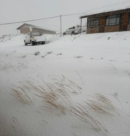
Gauteng residents, keep your eyes on the skies — snow is still possible today. Forecasters say the cold front gripping much of the country could bring light snowfall or icy precipitation to parts of Gauteng, especially in southern areas and the Highveld.
While weather models differ, one still shows flakes falling before the day is out. Here’s the latest update on what to expect and where conditions are most likely to turn wintry.
Vox Weather’s Michelle du Plessis said the ECMWF model was on Sunday once again hinting at the possibility of a few snowflakes in Gauteng.
“However, rain is also expected in these regions, which means any snow that does fall may melt quickly due to wet conditions.”
Send us your weather photos and videos to on WhatsApp on 083 625 4114 or email to bennittb@rekord.co.za.
She explained that on Sunday evening, a strong cut-off low (COL) pressure system is expected to develop over the western interior, following this past weekend’s cold front.
“The system will move slowly eastwards across the central interior and is expected to exit the country by Tuesday morning near the Wild Coast and southern coast of KwaZulu-Natal.”
Du Plessis furthermore said the biggest danger associated with this system is the tail of the COL, also known as the scorpion tail, which will bring the heaviest rain (100MM or more) from Monday evening into Tuesday morning over the central and eastern parts of the Eastern Cape, including OR Tambo, Amathole, Buffalo City, and surrounding municipalities.
“Widespread rain of up to 50MM is also likely in parts of the south-eastern Northern Cape, southern Free State, and southern KwaZulu-Natal.
“Freezing levels are expected to drop significantly on Monday, with widespread and HEAVY SNOW still likely over the northern high ground of the Eastern Cape, the southern Drakensberg, as well as the south-western and western high ground of KwaZulu-Natal and Lesotho. The heaviest snowfall is expected around Barkly East in the Eastern Cape (more than 50CM) and in Lesotho (20–50CM).”
On Sunday she said models continue to indicate the likelihood of light snow over the northern and eastern parts of the Northern Cape, across much of the Free State, and parts of the North West.
Authorities urge South Africans to prepare for widespread frost, strong winds, and icy conditions into the week, and to closely monitor updates as forecasts continue to evolve.