Snow now possible in Pretoria as MAJOR cold front approaches
The latest forecast puts Pretoria in the potential snow zone as bitterly cold weather approaches Gauteng. Here is your latest update.
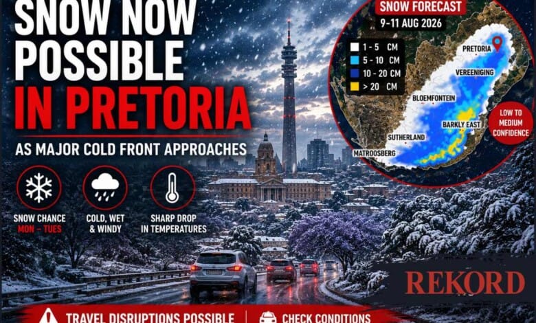
A rare chance of snow has emerged for Pretoria as a major winter system prepares to sweep across South Africa, bringing bitter cold, rain and potentially significant snowfall to parts of the country.
The latest snow forecast released by Vox Weather shows the potential snowfall area extending into Gauteng and as far north as Pretoria between Monday and Tuesday, August 10 and 11.
This marks a significant development in the forecast, after earlier projections placed the best chance of Gauteng snow mainly over south-eastern parts of the province.
However, Pretoria sits near the northern edge of the predicted snowfall area and Vox Weather currently places the Monday-to-Tuesday forecast in this region at low-to-medium confidence.
This means snow in Pretoria is possible, but far from guaranteed, and the forecast could still shift as the weather system develops.
Could Pretoria really see snow?
According to the latest Vox Weather map, light snowfall of between approximately 1cm and 5cm is possible across a broad area extending through Gauteng towards Pretoria.
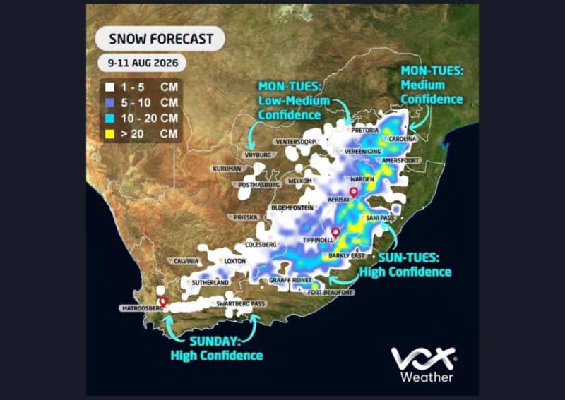
The map also indicates higher potential accumulations farther south and east, particularly towards Vereeniging and into parts of Mpumalanga, the Free State, KwaZulu-Natal and the Eastern Cape.
Whether snow actually falls over Pretoria will depend heavily on the eventual position, strength and movement of the developing cut-off low.
Even a relatively small shift could move the snow zone farther north, south, east or west.
Another factor will be whether temperatures near the surface become cold enough for snow to reach the ground rather than melting or falling together with rain.
Therefore, the forecast map should not be interpreted as confirmation that Pretoria will wake up under a blanket of snow.
It does, however, mean the capital is now firmly within the area being watched for possible snowfall.
Gauteng braces for cold and rain
Snow aside, Gauteng residents should prepare for a dramatic deterioration in weather conditions as the system moves across the country.
A strong cold front is expected to reach South Africa on Sunday, August 9, followed by the development of a cut-off low from Monday.
The Highveld could receive between 15mm and 30mm of rain within 24 hours on Monday, while isolated showers and thunderstorms are also possible over Gauteng.
A sharp drop in temperatures will accompany the system, bringing bitterly cold conditions to the province.
Earlier forecasts already identified south-eastern Gauteng, including Nigel, Benoni and Vereeniging, as areas where light snowfall could occur.
The latest Vox Weather map now extends that possibility considerably farther north towards Pretoria.
Monday and Tuesday will be crucial
Forecast confidence has improved considerably for the broader winter system expected on Sunday and Monday, with both the ECMWF and GFS models indicating significant snowfall over parts of the eastern interior.
Tuesday remains more uncertain.
The ECMWF model has indicated further snowfall over south-eastern Gauteng, the Mpumalanga Highveld, eastern Free State, Lesotho and southern Drakensberg, while the GFS model has been less aggressive with the extent of Tuesday’s snowfall.
The exact position of the cut-off low will ultimately determine which areas receive snow and how much falls.
Vox Weather’s latest map consequently gives high confidence to snowfall across some southern and mountainous areas, while confidence decreases towards the northern extent of the forecast area around Gauteng and Pretoria.
Travel could become difficult
The system could have an even greater impact on Gauteng residents travelling towards Mpumalanga, KwaZulu-Natal and the Free State over the long weekend.
Significant snowfall is possible across the Mpumalanga Highveld, eastern Free State, KwaZulu-Natal Midlands, Lesotho, southern Drakensberg and high-lying Eastern Cape.
Major travel disruptions are possible, with Van Reenen’s Pass and other mountain routes potentially affected or closed if heavy snowfall materialises.
Motorists have been reminded of the September 2024 snowstorm, when vehicles became trapped for hours as severe winter conditions brought major routes to a standstill.
For Pretoria residents, attention will now turn to the next model runs to see whether the capital remains within the potential snow zone as the system draws closer.
Vox Weather is expected to issue another detailed update on Sunday when forecast confidence should improve.
For now, snow in Pretoria is officially on the cards – but whether the capital actually sees flakes will depend on how the approaching system develops.
Also read: Electrocuted at Planet Fitness: Pretoria man finally discharged after month in hospital
Do you have more information about the story?
Please send us an email to bennittb@rekord.co.za or phone us on 083 625 4114.
For free breaking and community news, visit Rekord’s websites: Rekord East
For more news and interesting articles, like Rekord on Facebook, follow us on Twitter or Instagram or TikTok or WhatsApp Channel.