Stormy weather expected over SA from today
Brace yourself Tzaneen, severe thunderstorms with a risk of heavy downpours and strong gusty winds are expected from today over Limpopo.
A cold front moved over the country on Wednesday October 3 resulting in windy, rainy and cold conditions in the Western and Northern Cape provinces.
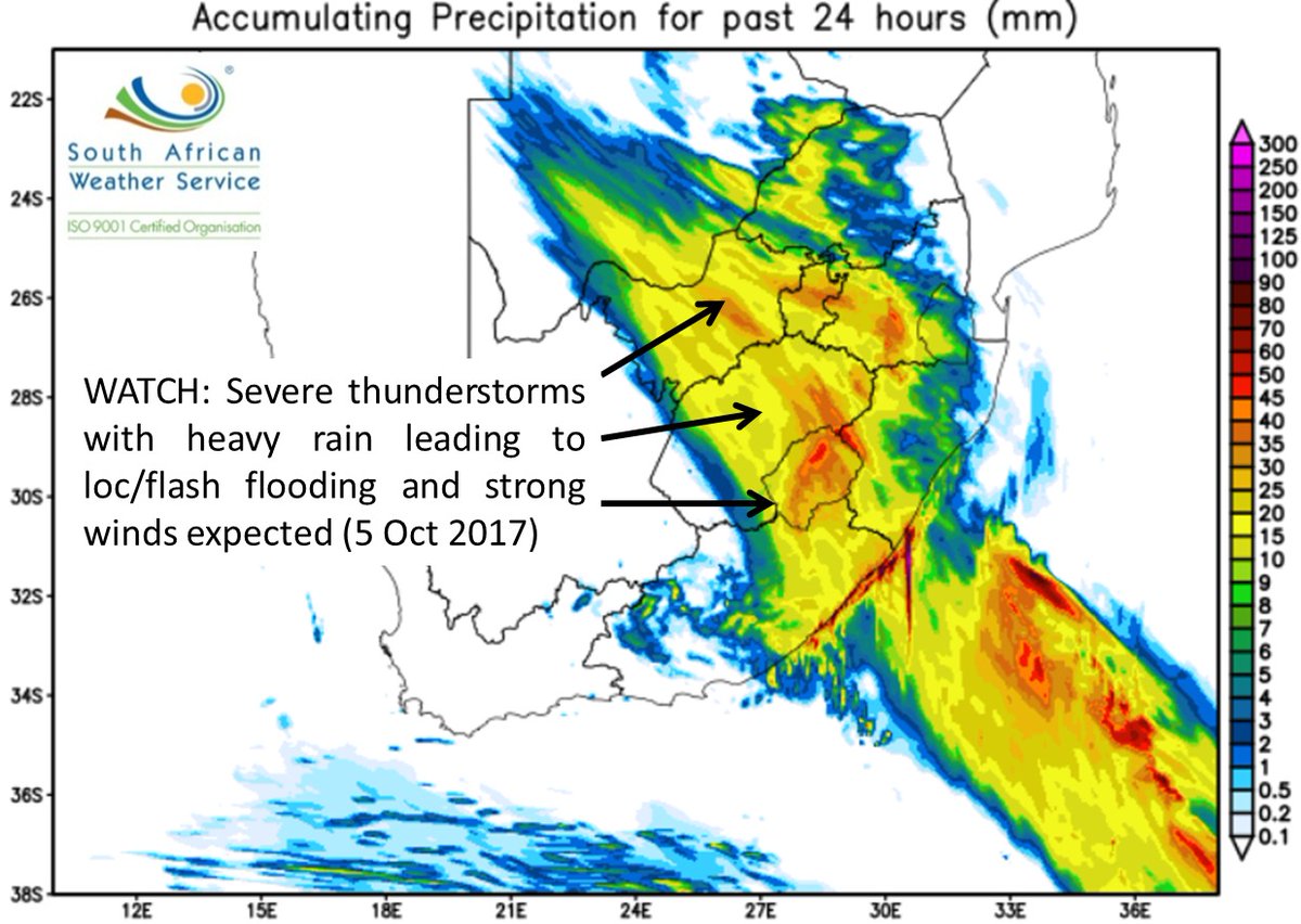
It is accompanied by an intense upper trough (extension of a low pressure in the upper portions of the atmosphere) which has resulted in a band of thundershowers through the western and central parts of the country, according to SAWeather.
Some of these thunderstorms are expected to become severe until the weekend, as they progressively spread east during the remainder of the week.
Listen to this Golden Oldie by Ge Korsten to get you in the mood for the predicted rain:
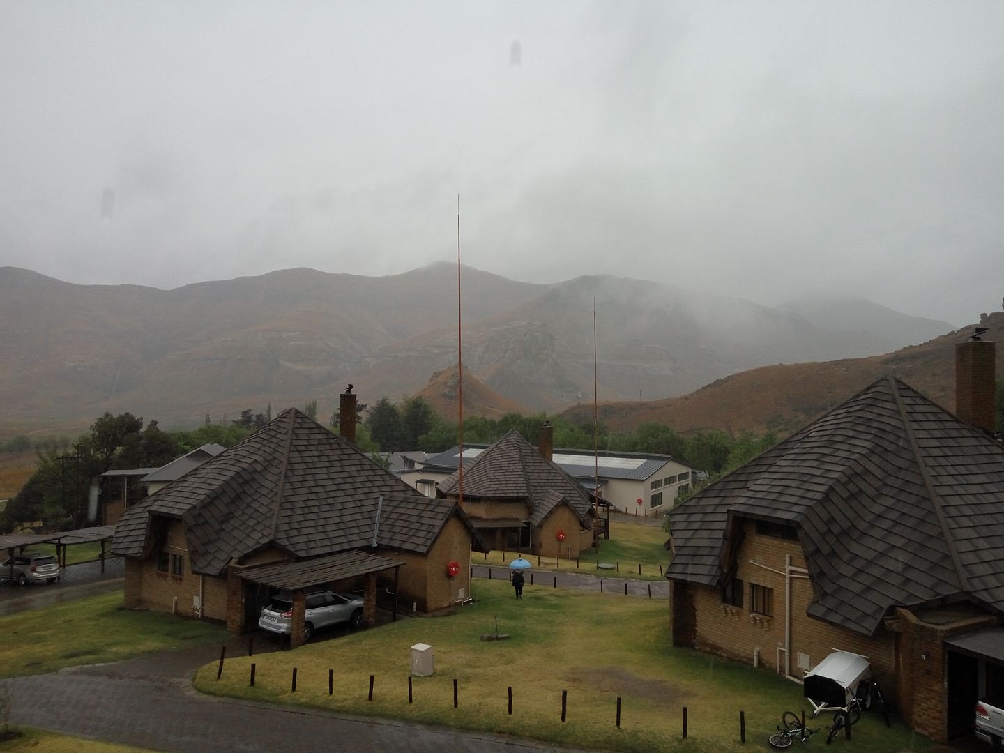
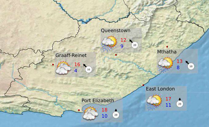
Light snowfalls are also expected on the mountains bordering the Eastern Cape and Lesotho.

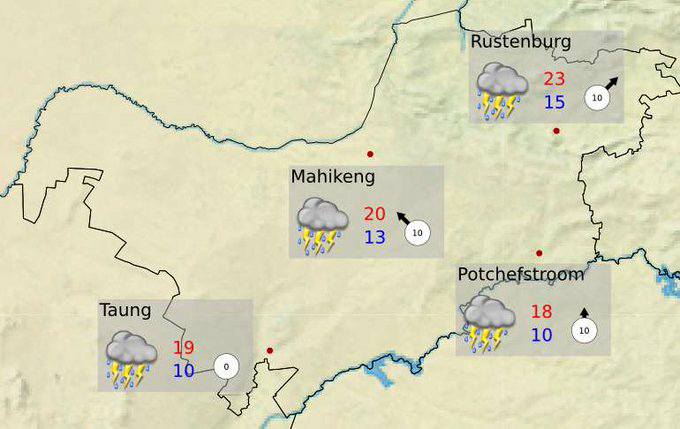
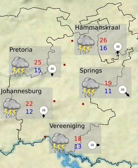
Severe thunderstorms with a risk of heavy downpours and strong gusty winds are expected over the western parts of North-West, western and southern Free State and the eastern half of Eastern Cape.
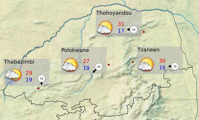
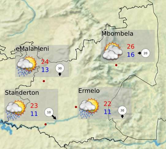
These conditions are expected to spread to the remainder of the Free State and North-West, KwaZulu-Natal, Mpumalanga, Limpopo and Gauteng by Thursday.
The risk for severe storms remains on Saturday over eastern parts of North West, Gauteng, Mpumalanga and Limpopo.
It will start warming up from Sunday.
As a result of this expected extreme weather, the public is made aware of the following possible impacts that can be experienced: Wet and slippery roads, occasional poor visibility.
Strong gusty winds would make for dangerous driving conditions, Heavy downpours will result in flash flooding in places which could lead to flooding of some settlements and roads.
Precautions to take during flooding
If walking outdoors, avoid crossing rivers and swollen streams where water is above your ankles.
· Just 15 cm of fast-moving flood water can knock a person off their feet, and a depth of 60 cm feet is enough to float a car.
· Never try to walk, swim or drive through fast-moving flood water. Stop, turn around and go another way.
· Listen to the special warnings on radio and/or television.
· Never drive into water covering the road. You would not know how deep it is or if the road has been washed away.
· If the vehicle stalls, leave it immediately and seek higher ground.
· Be especially cautious at night when it is harder to recognize flood dangers.
The South African Weather Service will continue to monitor further developments during this period and will issue subsequent updates as required.
Furthermore, the general public are urged to regularly follow weather forecasts on television and radio.
Updated information may also be accessed on www.weathersa.co.za as well as via the South African Weather Service Twitter account @SAWeatherService

Also read:
TZANEEN: Damage, but welcome rains bring relief
TZANEEN: Ex-Dineo brings some welcome rain
TZANEEN: Disaster Management on high alert as Dineo approaches
VIDEO: Dineo’s coming, be prepared
Dineo expected to bring heavy down pours this weekend
UPDATE: Dineo intensifies as NASA certifies her a cyclone