
Snow, rain and icy conditions expected
Brrr… Residents in several provinces are bracing for snow, heavy rain and damaging winds.

A weak cold front moving across the southern parts of South Africa today (July 27) has prompted a series of severe weather warnings for disruptive snow, damaging winds and heavy rainfall across multiple provinces.
The South African Weather Service (SAWS) has issued a Yellow Level 1 warning for damaging coastal winds and waves between Cape Columbine and Cape Agulhas in the Western Cape.
According to SAWS, the conditions could make navigation difficult for small vessels and personal watercraft.
Vox Weather forecaster Michell du Plessis told Pretoria Rekord that a strong high-pressure system, together with an upper-air disturbance, will draw bitterly cold air across the southern parts of the country, mainly affecting the eastern and southern Cape.
She said the most significant snowfall is expected tomorrow and Wednesday, when bitterly cold air combines with moisture over South Africa’s highest terrain.
Disruptive snowfall warnings
SAWS added that very cold and wet conditions are expected, with snowfall forecast over the high-lying areas of the Eastern Cape, particularly the Drakensberg, as well as the southern Free State and along the Lesotho border.
“Farmers are advised to take precautionary measures to mitigate the impact of the adverse weather conditions,” SAWS added.
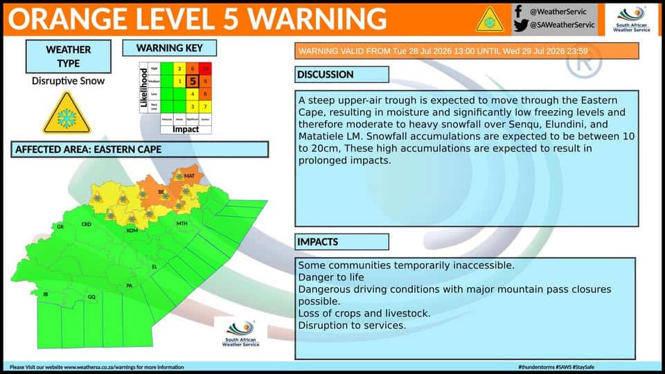
SAWS said an Orange Level 5 warning for disruptive snowfall has been issued for the Eastern Cape.
“A steep upper-air trough is expected to move through the Eastern Cape, resulting in moisture and significantly low freezing levels and therefore moderate to heavy snowfall of 10–20cm is expected,” it said.
SAWS added that some communities will be temporarily inaccessible, which could lead to the loss of crops and livestock.
Heavy rainfall in KZN
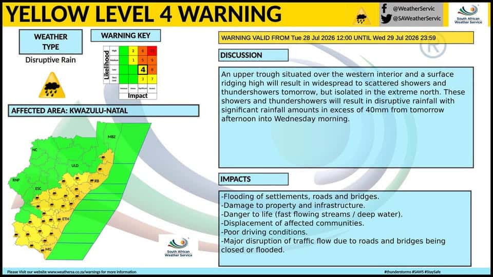
A Level 4 and Level 2 warning for disruptive rainfall has been issued in KZN, and residents are being urged to remain vigilant and avoid crossing flooded roads and rivers.
Damaging coastal winds
In the Western Cape, SAWS forecasts fine to partly cloudy weather, with cool to cold conditions. Cloudy weather is expected over the south coast and adjacent interior, with isolated showers and rain developing from the afternoon and becoming scattered over the south-eastern parts.
SAWS added that near-gale-force winds are expected along the south-west coast from the afternoon. Elsewhere, fresh to strong southerly to south-easterly winds are forecast, while the south coast will experience moderate to fresh westerly to south-westerly winds at first.
Cold conditions elsewhere
Elsewhere in the country, cold conditions are expected to continue, with frost forecast in several inland provinces.
Gauteng, Mpumalanga and North West can expect morning frost in places, followed by fine and cool conditions.
SAWS said the Northern Cape can expect fine and cool to warm conditions, although the south will be cold and become partly cloudy.
“The wind along the coast will be fresh to strong southerly to south-easterly,” said SAWS.
Breaking news at your fingertips… Follow Caxton Network News on Facebook and join our WhatsApp channel.
Nuus wat saakmaak. Volg Caxton Netwerk-nuus op Facebook en sluit aan by ons WhatsApp-kanaal.
Read original story on www.citizen.co.za