Three rings that aren’t
The Vredefort impact structure formed 2.023 billion years ago.
It is normal to refer to the three rings of the world’s largest confirmed asteroid impact structure — but it is misleading.
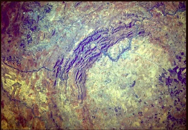
True, the Vredefort structure is vast and appears to have three deeply eroded rings. Johannesburg lies near the outermost one, associated with the Witwatersrand. Close to Parys and Vredefort is the apparent inner ring. Between the two — passing near the N1 tollgate at Grasmere — lies a less visible intermediate ring.
But these are not preserved outward ripples of the original crater. There is still debate about exactly how far the crater extended, although the best-supported estimates place its original diameter at approximately 250–300 kilometres.
The violence was almost unimaginable. In only minutes, the impact excavated an immense cavity, uplifted rocks from deep within the crust and pushed surrounding formations into steeply inclined and sometimes overturned positions. But claims that its circular mountains rose as high as the Himalayas remain speculative.
We know this was not the only enormous impact on Earth. It was, in fact, a latecomer, arriving long after the planet had acquired most of its mass.
Earlier impacts during the heavily cratered infancy of the Solar System may have delivered some water and other volatile materials, although Earth’s water probably came from several sources.
The Vredefort impact structure formed 2.023 billion years ago. Since then, erosion has stripped away many kilometres of rock — commonly estimated at about 7–11 kilometres. So, are the formations we see today the surviving surface rings of the original crater? The answer is an emphatic No.
But we do see what look like rings. What, then, are they?
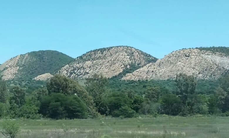
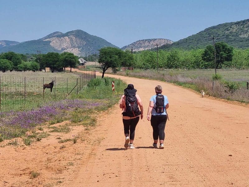
When you drive through the scenic Dome Bergland from Parys towards the quaint village of Venterskroon, three magnificent mountains rise to meet you at what we call the Gateway. They have strangely flat faces, while their layers stand almost upright like dinner plates in a drying rack.
These mountains contain some of the lower formations of the three-billion-year-old Witwatersrand Supergroup, tilted, rotated and, in places, overturned by the impact. Their flat faces follow resistant bedding planes created when sand and other sediments were deposited in the ancient Witwatersrand Basin by rivers, deltas, shorelines and shallow water.
Among the most conspicuous rocks is the white Hospital Hill quartzite. It belongs to the lower West Rand Group and is familiar to Johannesburg residents from places such as Linksfield Ridge and Orange Grove.
In that geological sense, the Dome Bergland is part of the Witwatersrand — except that it lies about 120 kilometres south-west of Johannesburg’s famous “ridge of white waters”. The rocks disappear beneath younger formations and reappear in great arcs elsewhere around the ancient impact structure.
That is how violently the impact remade this part of the Earth’s crust.
What excites geologists is that visitors can drive less than 100 kilometres on public roads and see some of the planet’s earliest rock formations displayed as Crust on edge. Few places on Earth make the deep structure of a gigantic impact so accessible.
This also explains why the apparent rings are not preserved crater rims. They are concentric geological exposures and resistant ridges revealed after the crown of the structure was stripped away by more than two billion years of erosion.
Glaciers crossed this region roughly 300 million years ago, when southern Africa lay much closer to the South Pole. Ice scoured parts of the surface, but it was only one contributor. Water, wind, weathering, differential erosion and, much later, the Vaal River all helped carve the landscape we see today.
It is convenient to call these formations the crater rings, but they are better understood as the exposed roots of a deeply eroded, multi-ring impact structure.
The name of the UNESCO World Heritage Site can also confuse visitors: the Vredefort Dome. The Dome is the geological central uplift of the impact structure, not a great rounded hill visible above the countryside. Today its deeply eroded interior appears more like a broad saucer of open veld and farmland, some 50 kilometres across, enclosed in places by the mountains of the Bergland.
So don’t go to Vredefort looking for a vast hole in the ground. It disappeared unimaginably long ago.
What remains around our information centre near Parys is something more revealing: a breathtaking panorama of mountains and ancient rocks exposing the deep roots of the greatest confirmed impact structure on Earth.
Come and see for yourself.Dome briefings, guided tours, school adventures and river activities.
BLAST! +27 84 245 2490https://vdome.co.za