Watch: Snowfall confirmed – Here’s what it means for Pretoria
Snowfall has been confirmed in several parts of the country, and cold weather conditions are expected to impact Pretoria in the coming days.
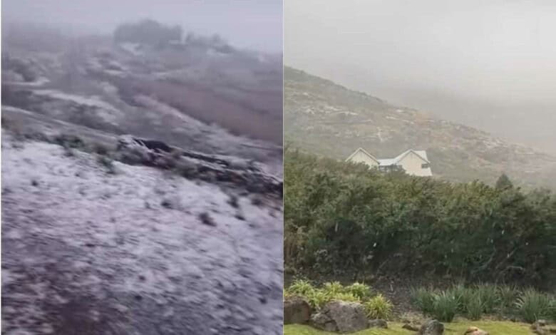
Residents across the country woke up to a winter wonderland as snowfall was officially confirmed, prompting weather warnings and a cold front expected to sweep across Pretoria and surrounding areas in the coming days.
On Wednesday morning, snow was confirmed in parts of KwaZulu-Natal, Lesotho and the Free State.
@rekordpretoria Watch: Snowfall confirmed – Here’s what it means for Pretoria Read more here: https://www.citizen.co.za/rekord/news-headlines/2025/05/21/watch-snowfall-confirmed-heres-what-it-means-for-pretoria/ Video: Facebook/Imogen Tarita #snow #southafrica #latestnews ♬ original sound – rekordpretoria
@rekordpretoriaWatch: Snowfall confirmed – Here’s what it means for Pretoria Read more here: https://www.citizen.co.za/rekord/news-headlines/2025/05/21/watch-snowfall-confirmed-heres-what-it-means-for-pretoria/ Video: Facebook/Da-Fan Monnea #snow #southafrica #latestnews

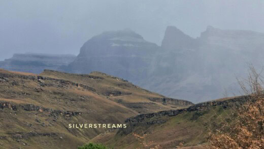
VoxWeather Meteorologist Michelle du Plessis said Wednesday will be the coldest day in Gauteng, followed by an icy Thursday morning (with minimum temperatures near freezing in the southern parts of Gauteng, where frost is possible) behind the front.
“We have a cold front arriving in the Cape on Tuesday, bringing cold air that will spread across the country.
“Wednesday will be cold in Gauteng (with maximum temperatures around 15 to 17°C) accompanied by a chilly wind, but rain is only expected over the Cape provinces, where snow is also possible over the high-lying areas. Most of the snowfall will occur over the southern Drakensberg and Lesotho.”
The following SA Weather Services (SAWS) warnings and advisories are in place until Wednesday:
Yellow Level 2: Damaging Winds and Waves are expected between Alexander Bay and Cape Agulhas from Tuesday, spreading to Plettenberg Bay from the evening, resulting in difficulty in navigation at sea and localised disruptions to small harbours and ports.
Yellow Level 2: Damaging Interior Winds are expected over the Northern Cape, the Central Karoo of the Western Cape, as well as Chris Hani and Joe Gqabi district municipalities, Dr Beyers Naude, Blue Crane Route, Raymond Mhlaba and Amahlathi local municipalities in the Eastern Cape, including the coastal areas between Plettenberg Bay and Algoa Bay. These conditions will lead to longer travel times, problems for high-sided vehicles on prone routes, localised damage to informal and formal settlements and communication/power disruptions.
Yellow Level 2: Disruptive Rainfall is expected over the Cape Winelands, Cape Metropole, West Coast and western parts of the Overberg Districts of the Western Cape on Tuesday (20/05/2025), leading to localised flooding of susceptible formal and informal settlements, roads, low-lying areas and bridges.
ADVISORIES:
A cold front associated with a steep upper air trough is expected to affect the Western Cape, Northern Cape and Eastern Cape Provinces from Tuesday into Wednesday.
The public and small stock farmers are advised that cold to very cold, wet and windy conditions with snowfall on the mountains are expected over the Western Cape and southern parts of the Northern Cape on Tuesday, spreading to the Eastern Cape overnight, where very rough seas can be expected along the coast from Tuesday evening into Wednesday.
Also read: EMS mitigates fire risk in Plastic, Cemetery View as winter cold starts to bite
Do you have more information about the story?
Please send us an email to bennittb@rekord.co.za or phone us on 083 625 4114.
For free breaking and community news, visit Rekord’s websites: Rekord East
For more news and interesting articles, like Rekord on Facebook, follow us on Twitter or Instagram or TikTok.