WATCH: Supercell thunderstorm responsible for Empangeni severe weather
The storm grew significantly in size and intensity throughout the afternoon
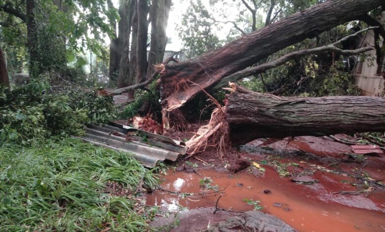
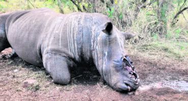
Satellite imagery yesterday (Monday) evening confirmed that the storm that wreaked havoc in Empangeni and surrounds late in the afternoon was the same system that brought much hail and severe weather to Howick in the Midlands earlier in the day.
This is according to the Severe Weather and Information Centre SA (SwaicSA) Facebook page whose meteorologist, Angelo Hoorn, said the storm grew significantly in size and intensity throughout the afternoon.
ALSO READ: WATCH: Thunderstorm leaves trail of damage in and around Empangeni
“At one stage, it grew two overshooting tops. Reports of the storm rotating suggest it may be a supercell thunderstorm of which the most intense part is currently just east of KZN,” Hoorn reported late Monday evening.
An overshooting top (or penetrating top) is a dome-like protrusion shooting out of the top of the anvil of a thunderstorm and into the lower stratosphere. When an overshooting top is present for 10 minutes or longer, it is a strong indication that the storm is severe.
These weather systems are responsible for heavy downpours; large hail or large amounts of small hail; excessive lightning, and damaging winds.
HAVE YOUR SAY
Like our Facebook page and follow us on Twitter.
For news straight to your phone invite us:
WhatsApp – 060 784 2695
Instagram – zululand_observer