Cyclone Dineo expected to hit Eastern Cape and KZN coastal areas
The whole of KwaZulu-Natal can expect a 60% chance of rain
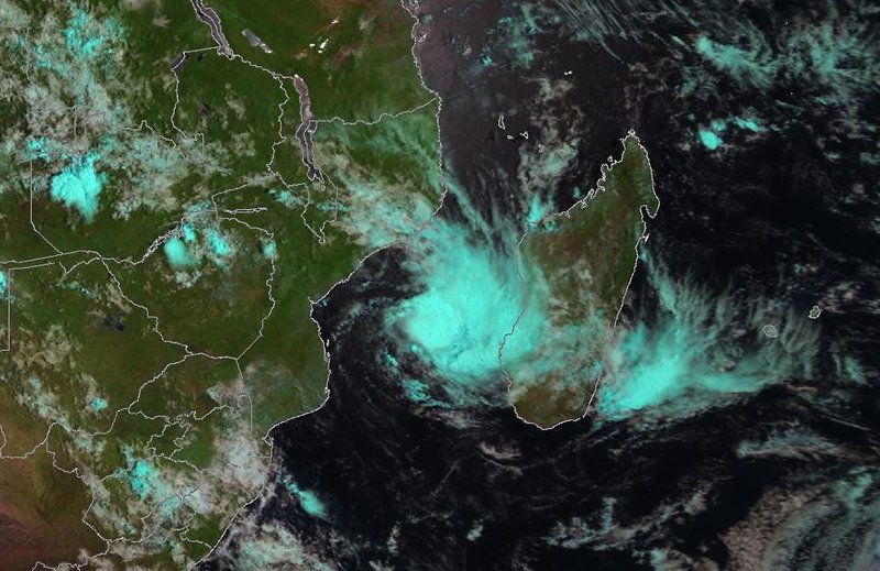
A Mozambican Cyclone is expected to hit the Eastern Cape and KZN coastal areas today (February 15).
The first signs of tropical cyclone Dineo will be visible over the East Coast of SA today, as the storm is expected to make landfall on Mozambique.
The South African Weather Service issued an update on the tropical storm on Tuesday, saying it is expected to reach cyclone status early on Wednesday (February 15).
Also read: Strong winds do more damage
Update: Cyclone Dineo downgraded to tropical storm and likely to miss Ladysmith, but heavy rain expected
Update: Update: Cyclone Dineo still remains on its predicted path, Ladysmith expected to have rain
The Regional Specialised Meteorological Centre (RSMC) La Reunion also updated the expected evolution of Dineo, which is now expected to reach Tropical Cyclone stage winds of up to 118-165km/h.
For Wednesday then, the South African Weather Service has forecast an 80% chance of rain along the East Coast north of Durban, up to the Mozambican border at the northernmost part of the East Coast.
The adjacent interior over Mpumalanga, Gauteng, the Free State, central and north-eastern parts of the Eastern Cape, the whole of KwaZulu-Natal, the southernmost parts of Limpopo and the south-eastern parts of the North West province can expect a 60% chance of rain.
Click to receive news links via WhatsApp. Or for the latest news, visit our webpage or follow us on Facebook and Twitter. Join us there!