Weather update – satellite image of storm watch
The South African Weather Service have updated their storm watch.
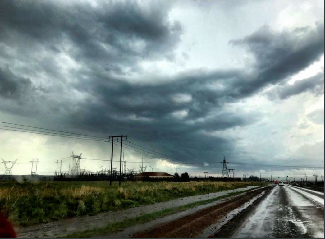
A recent satellite image of weather patterns this afternoon show where the highest storm risks are.
The SA Weather Service has left out the previously included Mpumalanga Highveld and named the western parts of KZN as well as parts of the Free State and North West the areas at risk, .
Afternoon satellite image (29 November 2017) – Showers and thundershowers over the central and eastern interior. WATCH for possible severe thunderstorms still valid over the western parts of KZN, northern and eastern parts of the FS and south-eastern parts of the NW. pic.twitter.com/koLs0KhhxN
— SA Weather Service (@SAWeatherServic) November 29, 2017
Other parts of Mpumalanga are getting some rain:
Warning:29/11/2017 15h30 TO:29/11/2017 18h00 Severe Thunderstorms- are observed between Piet Retief and Amersfoort in Mpumalanga moving slowly northwards at 26km/h to Amsterdam with heavy downpours which could lead to localized flooding..
— SA Weather Service (@SAWeatherServic) November 29, 2017
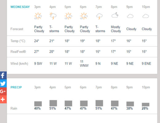
According to the AccuWeather forecast, the chance of rain in Middelburg remains around the 50% benchmark until 20:00 where after it decreases.
Other news:
Warning: Severe thunderstorms possible today
Woman suffocated, set alight and cut into pieces
Policeman hijacked, shot whilst returning from crime scene
Woman claims muti made her teeth fall out
Watch: Miss South Africa crowned Miss Universe 2017
Adopt a pet for Christmas, don’t buy one
Want breaking news on the go?
Add us on WhatsApp. Save the Middelburg Observer standby number 072 248 3855 on your phone and send a WhatsApp message with the words “Add me” to receive news links.