Videos: 5 provinces face storm warnings as snow falls in Lesotho
While snow blankets parts of neighbouring Lesotho, several South African provinces have been urged to prepare for flash flooding and disruptive rainfall.
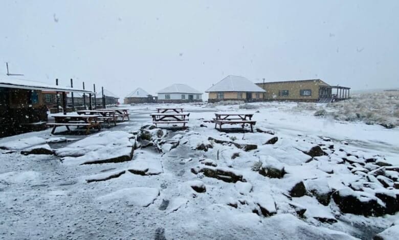
Snow may have fallen in neighbouring Lesotho, but most South Africans won’t see flakes this week.
Pretoria Rekord reports that VoxWeather forecaster Michelle du Plessis said no snow is expected in South Africa.
“Most of the rain and storms will clear up by tomorrow, but an onshore flow of cold air, caused by a high-pressure system wrapping around the east of the country, will still bring clouds and cooler weather for Pretoria tomorrow.
“We are not expecting snow in South Africa. It will be about two or three degrees cooler than today, but then temperatures will slowly start to rise again during the course of the week, with not much more rain expected for the rest of the week.”
Watch: Snow in Lesotho
Severe storm warnings issued
Meanwhile, SA News reports the South African Weather Service (SAWS) has issued severe storm warnings for various provinces, urging residents and motorists to exercise caution as unpredictable weather conditions unfold.
The eastern parts of the country, particularly Gauteng, are currently experiencing intermittent rain that significantly reduces visibility.
According to the agency, this warning encompasses several provinces, including Gauteng, Free State, Limpopo, Mpumalanga and KZN.
KZN high risk
A yellow Level 4 warning indicates the potential for severe thunderstorms accompanied by heavy downpours, primarily impacting central and northern KZN. Residents in these regions are urged to prepare for flash flooding in low-lying areas and on vulnerable roadways.
In addition, dangerous lightning and damaging winds may lead to localised damage to infrastructure, including homes (especially informal settlements), vehicles and agricultural livelihoods.
Another warning highlights disruptive rainfall anticipated in the southern parts of KZN, which could create hazardous driving conditions due to slippery roads and reduced visibility, increasing the likelihood of minor motor vehicle accidents.
Gauteng and Mpumalanga on alert
Meanwhile, two separate yellow Level 2 warnings have been issued in Gauteng and Mpumalanga. SAWS warns of severe thunderstorms expected to bring heavy rain and localised flooding in the extreme eastern regions, which could result in potential damage to infrastructure and property.
SAWS forecasts a significant drop in temperatures across the interior of the eastern half of the Eastern Cape, bringing very cold conditions that residents should prepare for, especially during morning and evening hours.
Limpopo and Free State
In Limpopo, the agency reported partly cloudy conditions in the southwestern bushveld and otherwise cloudy and cool weather with scattered to widespread showers and thundershowers. In the Free State, it will be clear in the extreme west, but otherwise, it will be partly cloudy and cool to cold with isolated to scattered showers and thunderstorms, which will be widespread in the extreme east.
“Motorists are urged to drive with increased caution, maintaining a safe following distance and adhering to local traffic advisories,” SAWS said.
Those living in flood-prone areas should take proactive measures to secure their property and be ready for potential evacuations if necessary. Residents are encouraged to stay updated with local news for real-time weather information and advisories.
Breaking news at your fingertips… Follow Caxton Network News on Facebook and join our WhatsApp channel.
Nuus wat saakmaak. Volg Caxton Netwerk-nuus op Facebook en sluit aan by ons WhatsApp-kanaal.
Read original story on www.citizen.co.za