
Weekend snow warning for Van Reenen
If this system holds its current path, there could be HEAVY falls in KZN and Lesotho
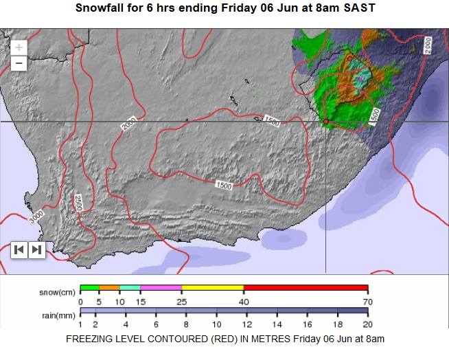
Heavy snowfall is expected in Northern KZN if the predicted weather front does not change course.
Areas affected, based on the current path of the system, are as follows: WC, EC, NC, KZN, Free State, Lesotho, and possibly Mpumalanga. According to the Snow Report SA facebook page, if this system holds its current path, there could be HEAVY falls in KZN and Lesotho.
However, they stress that “this is true for the current path of the system, and it may change course as it approaches the WC today.”
We will keep you updated on the weather front and the likelihood of heavy snow in Van Reenen as we get more information.
If you are planning to travel, using Van Reenen’s Pass, please pay close attention to all weather reports.
Heaviest snowfall is expected on Friday morning, which will most likely close Van Reenen.
LATEST SNOW UPDATE:
KZN and Lesotho are predicted to get the bulk of the snow. Snowfall will extend even as far as the KZN Midlands, but the snowfall will not be as heavy as initially predicted.
As of today (Wednesday morning) light snowfall is expected on Friday morning at Van Reenen. This may change, we will keep you updated.