Level 5 disruptive rain warning issued for Polokwane
The warning comes amid a cut-off low-pressure system that will cause heavy rain, strong winds, and potential flooding in affected areas.

POLOKWANE – The South African Weather Service (SAWS) has issued a Level 5 disruptive rain warning for Polokwane for today.
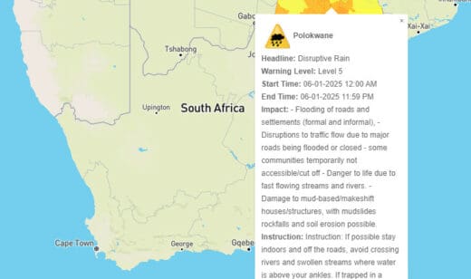
The warning comes amid a cut-off low-pressure system that will cause heavy rain, strong winds, and potential flooding in affected areas.
Read more: Heavy rainfall predicted for eastern South Africa this weekend
The SAWS has warned of flooding of roads and settlements (formal and informal); disruptions to traffic flow due to major roads being flooded or closed; danger to life due to fast flowing streams and rivers as well as damage to mud-based/makeshift houses/structures, with mudslides rockfalls and soil erosion possible.
“If possible stay indoors and off the roads, avoid crossing rivers and swollen streams where water is above your ankles. If trapped in a vehicle during a flood, abandon it and climb to higher ground. In buildings, move valuables to a safe place above the expected flood level,” their warning reads.
Weather outlook for Polokwane
A warm and unsettled week is expected for Polokwane, with temperatures ranging from the mid to high twenties.
Monday will see a high of 27°C, with evening thunderstorms predicted. This trend will continue into Tuesday, with temperatures rising to 28°C and humid conditions prevailing. Scattered thunderstorms are expected in various parts of the city.
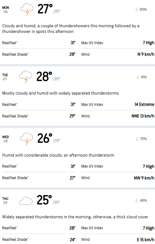
Wednesday will bring cloudy skies and a slight drop in temperature to 26°C, with evening thunderstorms forecasted. Thursday is expected to be the wettest day of the week, with rain predicted and a high of 25°C.
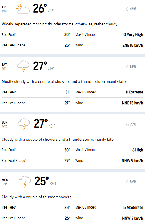
Friday will be overcast, with temperatures rising to 26°C. The weekend is expected to be warm, with highs of 27°C on both Saturday and Sunday. A couple of thunderstorms are predicted for both days.