
History of the Onderberg to be continued
Last year Corridor Gazette published a series of seven chapters following the ancient to the early history of the region, according to available documentation.
MALALANE – With this first chapter in the newspaper’s next series Corridor Gazette would like to recall shortly what happened earlier and up to the point when the first European trader set up a post on the banks of the Crocodile River during the latter half of the 1870s.
What is known as the Onderberg also includes places like Louisville, Schoemansdal, Buffelspruit, KaMhlushwa and, closer to the eSwatini border, Masibekela and KaMaqhekeza.
The most recent historical research and recording of the Onderberg are to be found in the book Historical Lowveld Across the Ages by the local historian Hans Bornman.

He writes about an ancient red ochre mine, situated six kilometres south of Malalane, known as Dumaneni. According to archaeologists, this mine is estimated to be between 28 500 and 46 000 years old and is regarded as one of the oldest in the world. The Swazi word for red ochre is “ludvumane” which means “power four times the sound of thunder”.
ALSO READ: Truck drivers bear the brunt of backlog at Lebombo border
The use of red ochre endows great power, and only chiefs and the most highly qualified priest diviners are permitted to wear it, covering their whole bodies and hair with the powder, mixed with animal fat.
Indications are that the San mined ochre on Dumaneni for centuries before the arrival of the first black nations. Hundreds of paintings done with this red ochre are still to be seen at places all over the Lowveld.
A group of Karanga people from the Zimbabwe area also mined red ochre at Dumaneni some 2 000 years ago. It was taken to the coast where Hindus shipped it to the East.
The reign of Sobhuza I from 1815 to 1836 introduced the formation of the Swazi nation. His successor, Mswati II, succeeded in uniting the various clans. Succeeding his father in 1845, Mswati II (1845-1865) commenced a career of large-scale raids and adventure.

He selected as his hunting ground the prosperous tribal lands of the various groups to the north of eSwatini, today known as the Onfderberg. He became wealthy and his crack regiments, such as the Nyatsi and the Malalane, brought terror to African settlements in the area and further afield.
Prior to all this on July 12, 1725 already, an expedition of the Dutch East India Company, led by Frans de Kuiper moved into this area from Delagoa Bay which at this rime was occupied by the Dutch. The group was attacked and return but attempted another two year later.
They got as far as Gomondwane in Kruger between the present day Crocodile Bridge and Lower Sabie. They became the first Europeans historically documented, to lay eyes on this area.
More than a century passed until the first white trader enters the area. João Dos Santos Albasini was born May 1, 1813 in Lisbon, Portugal. He came to Lourenço Marques in 1831 and became a trader and elephant hunter. The remains of his trading post can be found at the Phabeni Gate, 10 kilometres from Hazyview.
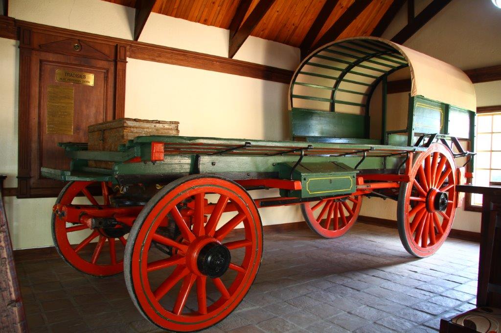
Lourenço Marques, now known as Maputo, was the starting point of many of the ancient trading routes often passing through the Onderberg area. With the inland movement of the first Voortrekkers, these became more permanent wagon tracks.
In 1844 a commission was sent forth by the Voortrekker leader, Hendrik Potgieter, to mark a proper route. This followed adjacent to the Onderberg area through the southern reaches of the present day Kruger Park.
Due to a lack of water north of the Crocodile a news wagon route, crossing the river at Hectorspruit, a few kilometres upstream from the more well-known Nellmapius drift, into the Onderberg was devised.
This road became known as the “Voortrekker Pad” and, for years, was the main link between the emigrants and Lourenço Marques. In 1855 this route handled annual imports of 100 000 kilograms of lead, 2 500 kilograms of coffee and 5 000 kilograms of sugar, as well as exports of products such as mealies, hides, salt, hippo teeth, buffalo horns and fresh produce.
By 1872 with the discovery of gold on the escarpment east of Lydenburg, only one small settlement, that of Mjejane, close to the current day Hectorspruit, and a few kraals along the fertile banks of the Nkomazi River, were to be found.
This was first documented by Emil Cohen, a Danish-born, German-trained geologist and cartographer, and is well documented in the recent publication by the Lowveld physician, Dr Gerrit Haarhoff’s Forgotten Tracks and Trails of the Escarpment and the Lowveld.
Cohen made rough drawings of the eastern spur of the Makhonjwa Range, demonstrating two prominent peaks, Taba Kalinte (Mthangaleni) and Taba Kulu (KuMahedle). He continued along a distinct path and probably crossed the Nkomati River at Furley’s Drift.
He continued towards Mathalla’s Poort, where he crossed the Lebombo Mountains. This section route through the area, later known as Strijdom Block, was in the same area as the Nellmapius route, which was about to be made and what would later become the Jock Trek 1885 route.
The discovery of gold on the escarpment east of Lydenburg in 1872 immediately demanded a better road between Lydenburg, via the diggings to Delagoa Bay or Lourenco Marques. The then president of the Zuid Afrikaanche Republic, Thomas Francois Burgers, pledged an amount of £1 500 for the first road building the project.
The road-building was divided into three sections, the last section traversing into the Onderberg area and passing the Lebombo at Mathallaspoort east of the current day Naas area.
Alois Hugo Nellmapius (1847-1893) a businessman and industrialist originally from Hungary, had adopted the old Transvaal as his new homeland. In 1875 he landed himself the concession to better, operate and maintain this road originally financed by the Transvaal government.

This concession included some loose standing farms along the way, of which those in the Onderberg was Lodwich Lust, (where Nellmapuis Drift is) Coopersdal and Castilhopolis, closer to the border with Mozambique.
These farms became postings where single European traders were established to stores along the way which was the first formal trade ever to happen in the Onderberg
Should you be interested to read all of the first series, please forward your email address to marius@lowveldmedia.co.za.
Keep an eye open for the next edition of Corridor Gazette which will be available on Friday 12 June to continue reading about the history of our region.
ALSO READ: UPDATE: Massive amount of drugs, alcohol and cash confiscated in Komatipoort