The high levels of soil saturation and full dams, combined with the La Niña weather system could lead to more trouble in coming months.

Cars negotiate flooded roads in Crown Mines, Johannesburg after heavy rainfall in November 2022. Picture: Neil McCartney/The Citizen
Almost the entire South Africa has received normal to above average rainfall since the start of the rainfall season; and according to a weather expert, the chances of more rain can’t be ruled out.
Nor can a potential disaster, considering how wet the country already is.
This is according to Dr Johan Malherbe, a senior researcher at the Agricultural Research Council, who told The Citizen on Monday this exceptional rainfall even included the country’s winter rainfall areas.
December’s weather systems
“The reason for the above normal rainfall over the winter rainfall region is a result of two big weather systems (referred to as cut-off-lows) which occurred in December,” said Malhere.
“The totals were around 50mm in those flat areas and a bit more in the mountainous regions, so it’s not a lot of rain but because the winter rainfall regions receive most of its rain between May and August,” he added.
This rain was quite exceptional for December.
Elsewhere, Malherbe said between November last year and early January this year, the entire country with the winter rainfall region included, received above-normal rainfall.
ALSO READ: ‘Vicious’ weather: Is heavy rain normal?
More rain still possible despite weakening of La Niña weather system
Malherbe is of the view more rain can still be expected between January and March this year.
“Seasonal forecasts at this stage are still leaning towards normal to wetter than normal conditions over the summer rainfall region and that is associated with La Niña,” he explained.
“However, La Niña is expected to weaken during the next few weeks and for that reason forecast models will become a bit more conservative for rainfall.”
“While drier conditions are on the cards over the next two weeks or so, we could still see a relapse of wet weather conditions and because we are still in a La Niña situation, even though its weakening, we are still in a better chance of above normal rainfall and for that reason the latest seasonal forecast still lean towards normal to above normal rainfall for the remainder of the summer rainfall season,” Malherbe said.
LISTEN: Expect a wet 2023, with above normal rainfall until expected till autumn
Teetering on the edge
Malherbe said: “The amount of rainfall that can cause a disaster depends on the intensity and the duration of the rainfall, so a one-in-a-10-year event would be enough to trigger floods in certain areas and a one-in-a-50-year event in certain areas.
“Our river systems are quite full, and it will not take January or early February,” Malherbe added.
Since late December, there has been a continuation of extreme weather conditions and thundershowers over the rainfall areas and according to Malherbe, this was due to some surface convection with the upper air support.
“This resulted in some good rainfall over large parts of the summer rainfall region with most of the rain really confined to the eastern parts of the country and if you look at the rainfall figures towards the east, most of KZN, the southern half at least, received in excess of 150mm of rain.
“Those types of totals are also seen along the Drakensberg, so the regions that received the most rainfall since late December is the southern to western KZN as well as the eastern parts of the Eastern Cape,” said Malherbe.
Meanwhile, long-term weather forecaster at the South African Weather Service (Saws) Dr Christien Engelbrecht says the country’s vulnerability to flood events is about more than infrastructure.
“If we reflect on the April 2022 floods in KZN, it was very clear that regions in eThekwini that are zoned to be danger areas during flood events have been inhabited by people.
“Here it is referred to areas along riverbanks of major rivers such as the Umgeni and areas along steep hill slopes that are prone to mudslides during periods of excessive rainfall,” said Engelbrecht.
Flooding caused significant damage:

The effect of the heavy rainfall was already being felt with the Dusi river overflowing in places and reports of craters forming in roads in Pietermaritzburg. Photo: Nwabiso Dlamini

A motorist jumps to his partially submerged car in Soweto, 9 December 2022, after it was swept away by flash floods on Friday morning after heavy rains overnight. Persistent rain affected various parts of Johannesburg. Picture: Nigel Sibanda


Photo: Twitter/@Crime Air Network

A man looking for recyclable items along Blue Lagoon Beach in Durban where trash washed up after the floods that swept through KwaZulu-Natal, 13 April 2022. Photo: citizen.co.za/ Jacques Nelles

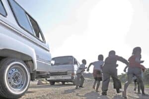
Parts of Lenasia flooded on 9 December 2022. Photo: Supplied

Nana’s Farm resident Nompumelelo Mvelase carries her cupboard near Lenasia in Johannesburg, 9 December 2022, after water flooded the informal settlement. Picture: Nigel Sibanda

Laingsburg floods on 3 November 2022. Image: Video screengrab

Picture: Screengrab
What will happen if heavy rain persists?
“With the high levels of soil saturation and the high dam levels (over the summer rainfall region), more rainfall can pose challenges.
“It is possible to lessen or avoid disastrous impacts if early action is taken in response to early warning in many instances.
“For example, to evacuate the vulnerable out of dangerous areas and it is, however, not always possible to avoid some disasters, for example, to prevent waterlogged agricultural lands,” Engelbrecht said.
How much rainfall has been recorded?
After a wet festive season over most of the country, Engelbrecht says widespread rain continued in the beginning of this year.
“Rainfall data for the first week of January 2023 (1-7 January 2023) indicated that most of the country received rainfall.
“However, the rainfall figures vary quite a lot, with rainfall figures of up to 10 mm that was recorded over the western parts of the country, whilst the highest rainfall figures were recorded along the southeastern and eastern coastal belts and adjacent interior regions,” said Engelbrecht.
She says over the north-eastern parts of the Eastern Cape and southern parts of KwaZulu-Natal up to 100 mm were recorded in some places.
“The highest accumulated rainfall over this 7-day period was recorded over the far northern coastal parts of KwaZulu-Natal while the rainfall that occurred so far this year over most of the western interior is far above average for this time of the year,” Engelbrecht added.
Areas which received the most rainfall:
- KwaZulu Natal – between 300 and 500mm
- North-eastern Free State – between 350mm and 450mm
- Southern half of Mpumalanga – between 350mm and 450mm
- Gauteng – between 20mm and 100mm
Lessons learnt from KZN floods:
“The floods which occurred in KZN in April of 2022 were quite big but we have seen much much bigger floods in the past,” Malherbe said.
He explained: “Particularly the 1987 September floods were much more extensive, with much higher rainfall and much bigger potential damage.”
“The lessons learnt this time around, I think between the weather service and the national disaster management centre, including the provincial disaster management centre is that had some talks after the event, and I know that there has been some progress made about the communication between the disaster management centre and the weather service for the cases of extreme rainfall events that can happen.”
ALSO READ: KZN floods: 87 people still missing