Here's what to expect on Friday.

Severe thunderstorms are expected across the country, again. Photo: iStock
The SA Weather Service has issued a yellow level 2 warning for severe thunderstorms with strong damaging winds, hail and heavy down pours expected over the North West, excluding extreme west and south-western parts, Gauteng, Highveld and escarpment areas of Mpumalanga, extreme north-eastern parts of Free State and the western half of KwaZulu-Natal.
A yellow level 1 warning for Severe Thunderstorms was also issued for the eastern half of the Eastern Cape, except Buffalo City, where there is expected localised damage to property, posing risk to life.
Extremely high fire danger conditions are expected over the Khai-Ma and Karoo Hoogland Local Municipalities of the Northern Cape and Beaufort West Local Municipality of the Western Cape.
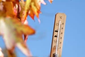
Furthermore, a heat wave with persistently high temperatures is expected in places over Mnquma, Mbhashe, Intsika Yethu, Engcobo and Alfred Nzo Local Municipaities as well as the OR Tambo District Municipality of the Eastern Cape until Saturday.
Friday’s weather forecast
Gauteng:
Partly cloudy and warm with scattered showers and thundershowers.
The expected UVB sunburn index: High
Mpumalanga:
Partly cloudy and cool to warm with isolated to scattered afternoon showers and thundershowers.
Limpopo:
Partly cloudy and warm to hot but very hot in places in the Lowveld and Limpopo Valley. Isolated thundershowers are expected in the extreme south.
North West Province:
Partly cloudy and warm to hot, with isolated to scattered showers and thundershowers.
Free State:
Partly cloudy and warm, with scattered showers and thundershowers, but isolated in the west.
Northern Cape:
Fine and warm to hot, but partly cloudy in the east with isolated showers and thundershowers. The wind along the coast will be moderate south-westerly.
Western Cape:
Morning fog patches along the coast, except over the west coast, otherwise cloudy and warm, becoming partly cloudy from the afternoon, while clearing over the central and eastern parts in the evening.
Isolated showers and thundershowers are expected over the north-eastern parts in the afternoon where it will be hot in places. The wind along the coast will be light and variable, becoming moderate to fresh west to north-westerly, but south-westerly along the south coast where it will be strong at times.
The expected UVB sunburn index: Very High
Western half of the Eastern Cape:
Fine and hot but cool along the coast, becoming partly cloudy with isolated showers and thundershowers. The wind along the coast will be light easterly, becoming south-westerly in the afternoon.
Eastern half of the Eastern Cape:
Fine and hot but warm along the coast, becoming cloudy with isolated to scattered showers and thundershowers. The wind along the coast will be light and variable, becoming moderate to fresh north-easterly.
KwaZulu-Natal:
Morning fog over the interior, otherwise partly cloudy and warm with scattered showers and thundershowers, but isolated along the coast and adjacent interior. The wind along the coast will be moderate north-easterly, becoming fresh in the afternoon.
The expected UVB sunburn index: Extreme