Showers and thundershowers also expected over the eastern interior of the country on Friday.

Picture: iStock
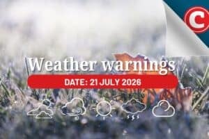
The South African Weather Service (SAWS) has issued an alert for isolated showers and thundershowers over the eastern half of the country on Thursday.
Extremely high fire danger conditions are expected over the Greater Taung Local MunicipalIty of the North-West, Kgatelopele, Tsantsabane, Siyancuma, Gamagara and Dikgatlong Local Municipalities of the Northern Cape as well as Mohokare and Mangaung Local Municipalities of the Free State.
“Conditions are such that the FDI index is above 75. Under these conditions, fires may develop and spread rapidly, resulting in damage to property and possible loss of human or animal life,” warned the weather service.
ALSO READ: Isolated showers and thundershowers expected in most parts of SA
Showers and thundershowers also expected over the eastern interior of the country on Friday.
On Saturday, isolated to scattered showers and rain is expected along the cape coast as a cold front approaches.
Isolated to scattered showers and thundershowers are also expected over the eastern interior of the country.
Thursday’s weather forecast
Gauteng: Partly cloudy and cool to warm with isolated afternoon showers and thundershowers. The expected UVB sunburn index: very high.
Mpumalanga: Partly cloudy to cloudy and warm to hot with isolated showers and thundershowers except in the extreme north-east.
Limpopo: Cloudy in the east in the morning and evening, otherwise partly cloudy and warm to hot with isolated afternoon showers and thundershowers in the south.
North West: Fine in the east, otherwise partly cloudy and warm with isolated showers and thundershowers.
Free State: Fine and cool to warm with isolated showers and thundershowers over the central and eastern parts.
ALSO READ: WEATHER: Disruptive waves – Beware of being swept off to sea
Northern Cape: Morning fog patches along the coast, otherwise fine and cool to warm, becoming partly cloudy with isolated showers and thundershowers over the north-eastern parts.
The wind along the coast will be moderate to fresh southerly to south-easterly.
Western Cape: Cloudy with morning fog over the southern parts and along the west-coast, otherwise fine and cool but warm over the extreme north-east interior.
The wind along the coast will be moderate to fresh south-easterly but light north-westerly along the south-coast. The expected UVB sunburn index moderate.
Western half of the Eastern Cape: Partly cloudy and cool with isolated light rain along the Tsitsikamma coast in the morning. The wind along the coast will be moderate south-westerly from midday.
Eastern half of the Eastern Cape: Partly cloudy and cool with isolated light rain near Port Alfred. The wind along the coast will be light westerly becoming moderate south-westerly from midday.
ALSO READ: As weather catastrophes become more common being underinsured can be devastating
KwaZulu-Natal: Partly cloudy and warm. The wind along the coast will be moderate to fresh north-easterly. The expected UVB sunburn index: high.