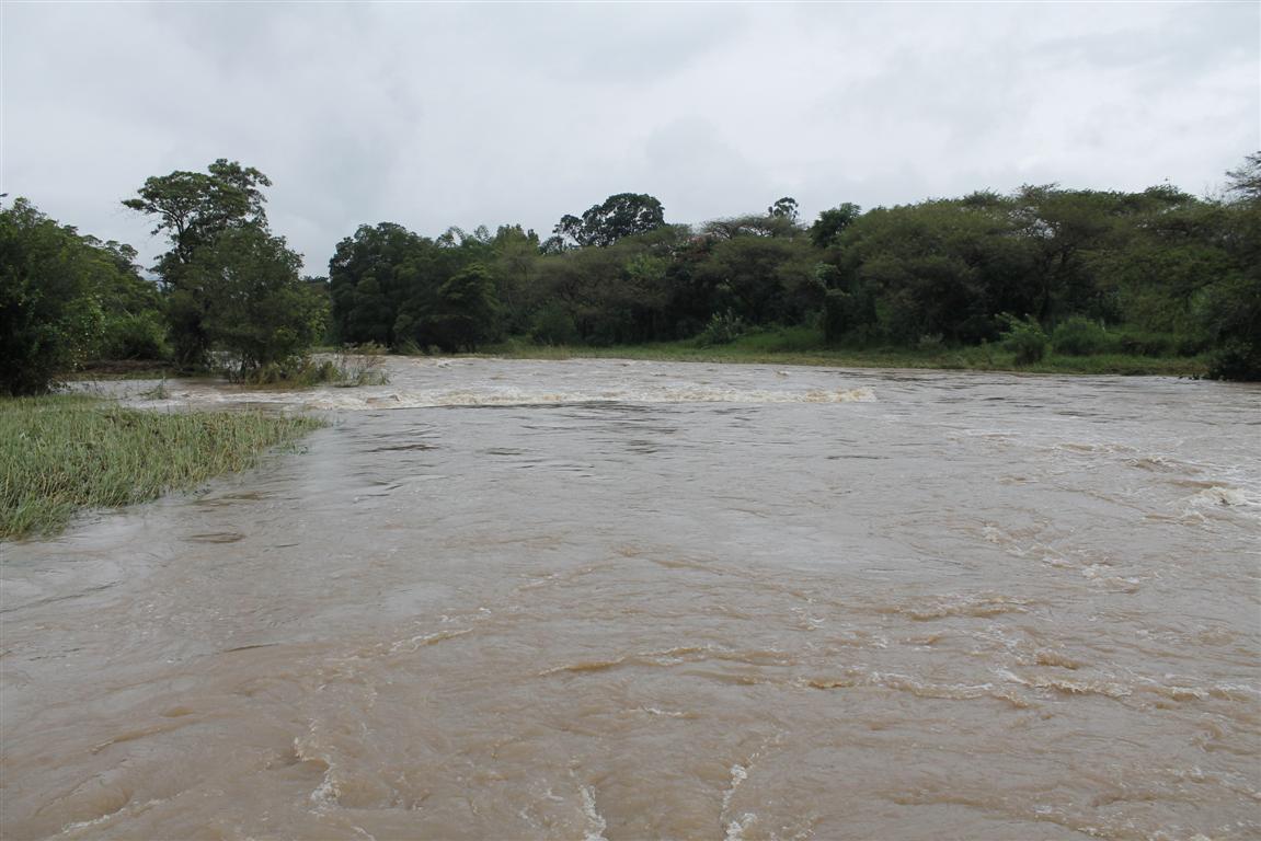
NELSPRUIT – Lowvelders have welcomed the sun today after having experienced heavy rain and overcast weather for days on end. However, this joy will be short lived as the South African Weather Service (SAWS) has warned that more rain is expected tomorrow which may result in more flooding.
According to Mr Mkhushulwa Msimanga, senior forecaster at SAWS, the heavy rains of the past week were caused by the presence of an upper-air trough (extension of a low pressure) in the upper portions of the atmosphere and allowed for plenty of tropically-sourced air mass to be drawn into the eastern and north-eastern parts of the country. Flooding occured in the eastern parts of North West, Limpopo, Mpumalanga and Gauteng provinces as well as northern parts of KwaZulu-Natal.
Yesterday, the upper-air trough was positioned over the western extremes of the country, with a band of moisture extending from Botswana eastwards and south-eastwards over the eastern parts of the country. This has resulted in cloudy to overcast conditions dominating these areas. Further widespread showers and rain, combined with a risk of possible localised flooding, are likely to persist over Gauteng, Mpumalanga, Limpopo, the eastern parts of North-West and the Free State as well as the northern areas of KwaZulu-Natal.
Today, the upper-air trough will move into the central interior, with a surface trough deepening over the western parts. Consequently, the chance of showers and thundershowers (which may be heavy in places) will increase over regions such as North West, the Free State as well as parts of the Eastern Cape, thus broadening the general area over South Africa where rain may be expected.
In general, rainfall probability over the eastern half of the country will remain fairly high up to and including tomorrow. By Friday and Saturday, the upper trough (which is currently a major contributor to the rain pattern) will have moved eastwards, away from the country, allowing conditions to become sunnier and warmer, with only a small chance of showers or thundershowers, which are mostly likely to be light in nature.
“It should be noted that the levels of soil moisture in many places remain high and thus it would not require much further rain to cause flooding. Therefore, communities living along riverine environments are urged to remain on high alert. Low-water bridges are also prone to flooding under such conditions and motorists are urged to be vigilant, especially at night and/or in conditions of limited visibility,” Msimanga warned.