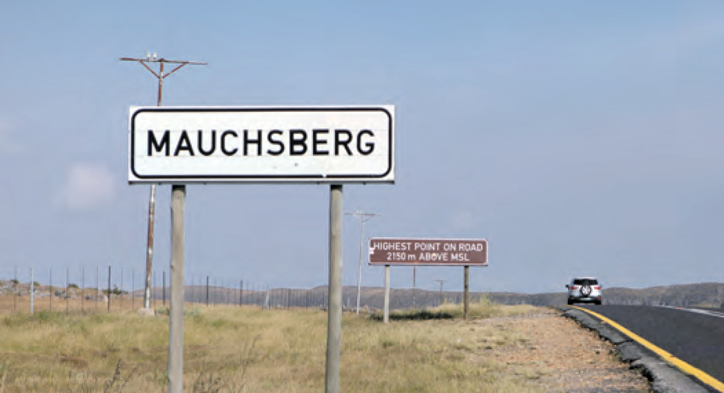
An overview of crossing Mauchsberg down into the Sabie Valley
Crossing the mountains from Lydenburg to Sabie and further down into the Lowveld was marked by four different passes, each quite extraordinary for its time.
First was the Old Harbour Road, commissioned by the Transvaal government from Thomas Francois Burgers after the discovery of gold at Hendriksdal and Mac-Mac in 1873.
This route, later to be known as the Nelmapius Concession all the way to Delagoa Bay, served as a treacherous wagon route down Mauchsberg until the late 1920s, when the first of three motor roads were built.
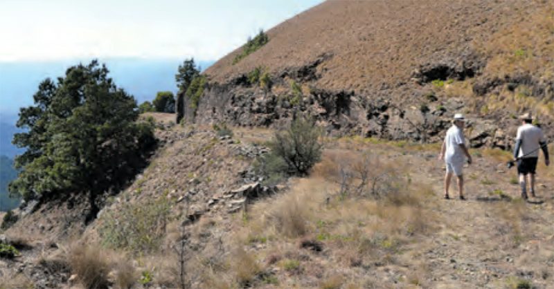
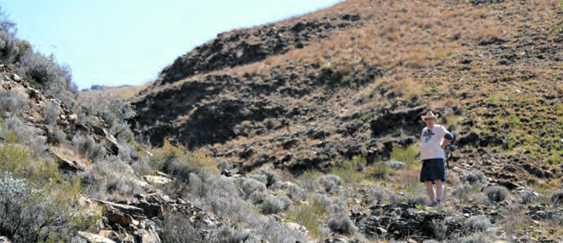
This route is the road still visible swerving left across the road from the entrance to Hops Hollow over the plateau and straight over the edge. This well-built but narrow, and at places somewhat hair-raising, the road still clings to the diabase with just a low stone wall between the road and the dizzy height down the upper Sabie River Valley. It is not open for general traffic anymore, and the gate at the top is only unlocked by special arrangement.
But be warned: this is not for the faint-hearted. I will have to go back to my references, but I recall reading somewhere about the local Lydenburg Anglican priest at one stage also having to serve the congregation in Sabie with a second service on Sunday afternoons. He recalled in some memoirs Harbour Road was revisited and surveyed.
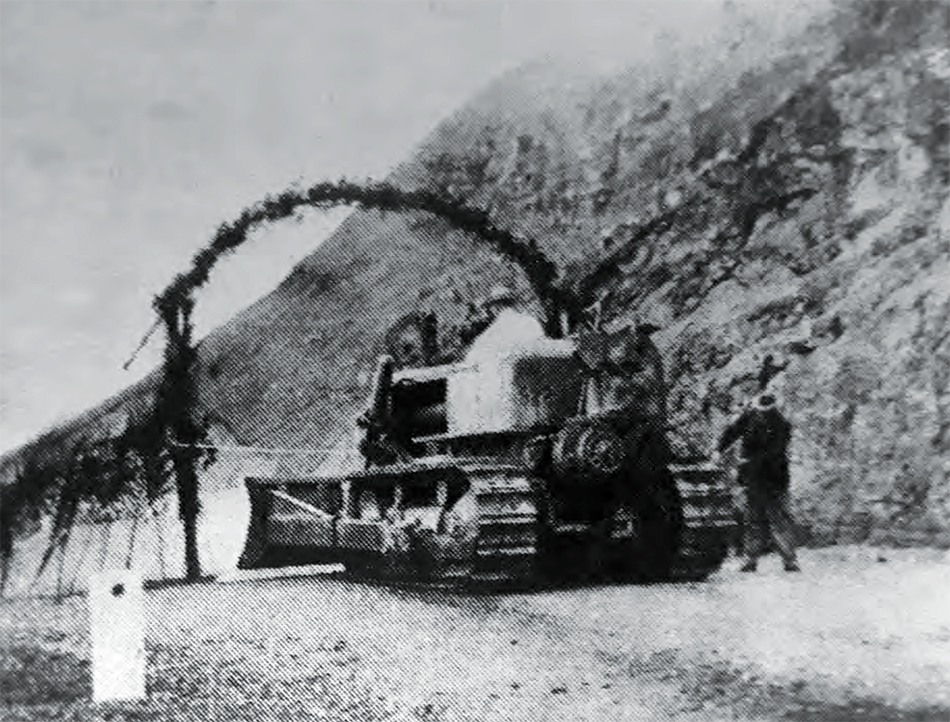
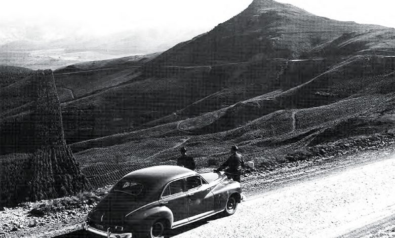
The new, or first Long Tom Pass, was opened as a gravel road in 1953. Within 10 years, the trajectory of the road underwent a further straightening out, after which the road as we know it today was tarred and reopened in 1964.
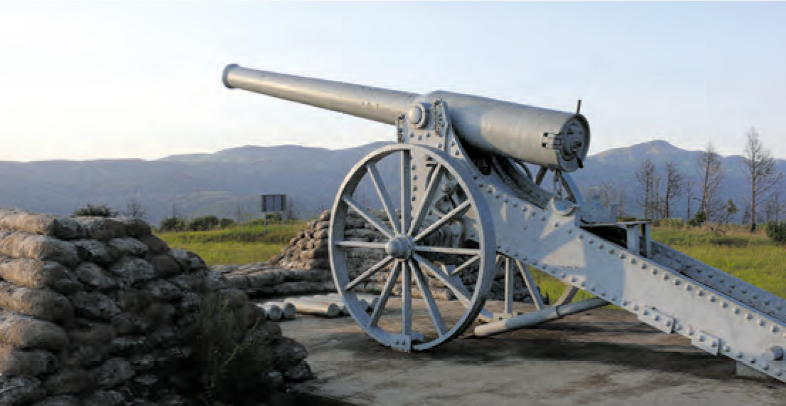
It was also with reopening the third pass that a replica of the famous Long Tom canon was modeled in the old railway workshop at Barberton, to be placed on the spot where the last of the original Boer Long Toms were used in battle during the Anglo Boer War.
Today the Long Tom Pass is also home to no fewer than three of the most cosy high-altitude inns of the escarpment: Paardeplaats Nature Retreat (www. paardeplaatsnatureretreat.co.za), Hops Hollow Country House, and Brew Pub (www.hopshollow.co.za) and Misty Mountain (www.mistymountain.co.za).
Also read the well-researched Forgotten Tracks and Trails of the Escarpment and the Lowveld by Dr Gerrit Haarhoff for the full story on these passes and other wagon routes and roads passing through this region at various stages.
Researched from archival sources and contemporaneous literature, Forgotten Tracks and Trails documents the origin and development of towns and their roads in the nineteenth century.
The wheel was late to arrive in the Lowveld, as it was only in the 1830s that the first explorers and emigrants ventured far inland in their ubiquitous ox wagon.
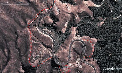
Describing the events as they unfolded and the people involved, this book gives an accurate and concise history of the period leading up to the establishment of the Eastern Railway Line. Using the latest drone technology, forgotten roads can again be identified as they cross mountain passes and ford drifts.
The aerial photography series of 1935 was used extensively to identify and accurately pinpoint the old highways. The overlay technology of Google Earth made it possible for the first time to create accurate maps of the original wagon tracks.
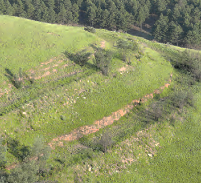
Cutting-edge Lidar technology was used to determine the old roads where forestry had destroyed the marks and gouges through cycles of replanting. Exploring the timelines and narrations of the time, the author debunks previously held myths by meticulous reasoning and proof. The book is available at bookstores and at the offices of Kruger Lowveld Tourism at Crossing in Mbombela.