WEATHER WARNING: SAWS predicts severe thunderstorms for the weekend
Severe thunderstorms and flooding are predicted for Mpumalanga this weekend, according to SAWS.
A sustained spell of tropically sourced rainfall is expected over a large part of southern Africa, particularly across the central and eastern interior in the next few days, according to SAWS.
A statement issued by SAWS, shows thunderstorms are expected to accompany the rain, with some storms likely to become severe, bringing heavy downpours and a distinct risk of localised flooding.
“An upper-air trough currently dominates the circulation pattern over the central interior of South Africa, resulting in scattered to widespread showers and thundershowers over the eastern part of the Northern Cape, the western part of the Free State, and most parts of the Eastern Cape,” SAWS said.
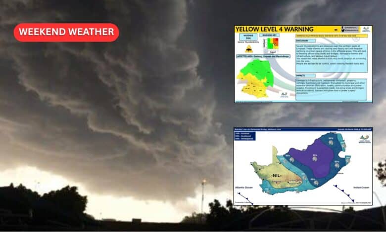
An orange level 5 warning for severe thunderstorms has been issued for parts of the Free State and Northern Cape for today, Thursday, March 5.
“These storms are expected to be severe and may be accompanied by heavy downpours that could lead to flooding of roads, settlements, and low-lying areas, as well as damaging winds, large amounts of small hail, and excessive lightning. Localised infrastructure damage, disruptions to traffic, and dangerous outdoor conditions may occur in affected areas,” according to SAWS.
The weather service said the upper-air system is expected to evolve into a tropical temperate trough (TTT) over the eastern and north-eastern parts of the country.
“A TTT is a rainfall-producing weather system that typically transports significant amounts of moisture from the tropical regions of Africa into the mid-latitudes, assisted by a mid-latitude upper-air trough, often resulting in widespread and persistent rainfall over large parts of the country.”
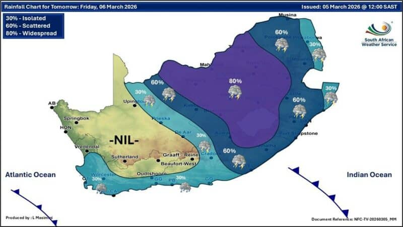
This system is expected to further develop and intensify over the eastern interior from Friday, March 6.
Persistent rain and thundershowers are predicted over parts of the North West, the Free State, KwaZulu-Natal, Gauteng, Mpumalanga, and Limpopo provinces.
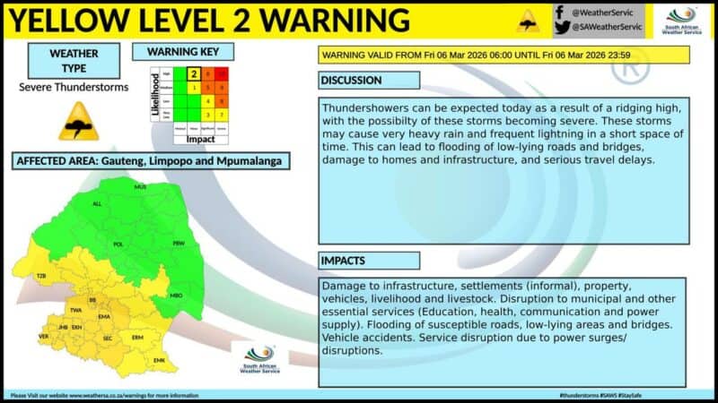
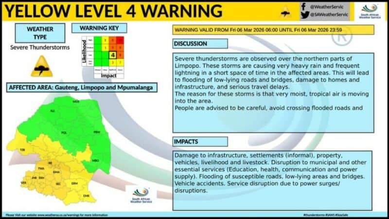
An orange level 5 warning for severe thunderstorms has been issued for North West and the Free State for Friday, while yellow level 2 and yellow level 4 warnings have been issued for Gauteng, Mpumalanga, Limpopo, and KwaZulu-Natal.
“The TTT-system is expected to move further east on Saturday, March 7 and Sunday, March 8, with the rainfall band shifting towards the north-eastern parts of the country. Widespread showers and thundershowers are, therefore, expected over the Lowveld areas of Limpopo and Mpumalanga, which remain vulnerable due to saturated soil and the potential for additional runoff. This may increase the risk of localised flooding of rivers and low-lying areas, particularly where heavy rainfall persists, SAWS warned.
The SAWS will continue to monitor the system closely and will issue updates as new information becomes available.
The public and relevant authorities are urged to follow official weather warnings and advisories from reliable sources.
* This article was amended after publishing