
Find out what the latest weather forecast from the SA Weather Service means for your region on 4 October 2025.
Picture: Canva
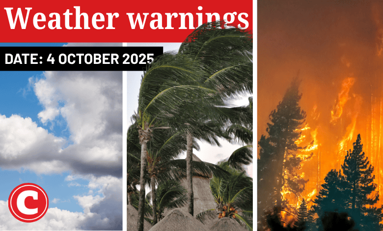
The South African Weather Service (Saws) has released its latest weather forecast for Saturday, 4 October 2025.
Expect partly cloudy skies throughout the country, with damaging winds forecast over parts of KwaZulu-Natal, the Eastern Cape, the Free State and the Northern Cape. Meanwhile, Saws has issued fire danger warning for certain parts of the three Capes, the Free State, and North West. Here’s what you need to know.
Weather warnings, Saturday, 4 October
Impact-based warnings
Saws has issued a yellow level 4 warning for damaging winds along the coast between Port Edward and Cape Vidal in KwaZulu-Natal as well as the adjacent interior. Expect major build-up of sand on coastal routes, localised disruption of small harbours or ports for a short period of time and damage of settlements and infrastructure.
A yellow level 2 warning has been issued for damaging winds and waves between Algoa Bay in the Eastern Cape and Port Edward in KwaZulu-Natal. This could result in localised difficulty in navigation of small boats and vessels taking on water and capsizing within a locality in places along the coast.
The weather service has also issued a yellow level 2 warning for damaging interior winds resulting in damage to settlements, and problems for high-sided vehicles in the southern parts of the Free State and Northern Cape.
Fire danger warnings
Expect extremely high fire danger conditions over the Central and Little Karoo in the Western Cape, Sarah Baartman, Chris Hani and Walter Sisulu in the Eastern Cape, and in places over the Northern Cape, the western and southern parts of the Free State, and the south-western parts of North West.
ALSO READ: Clouds hanging over Cape Town? What weather to expect this weekend
Provincial weather forecast
Here’s what to expect in your province on Saturday, 4 October:
Gauteng:
Residents of Gauteng can expect a partly cloudy and cool Saturday ahead.
Mpumalanga:
Expect morning fog patches over the Highveld and along the escarpment with drizzle, otherwise it will be partly cloudy and cool but warm in places in the Lowveld.
Limpopo:
The day will start with morning fog and drizzle along the escarpment, otherwise conditions will be partly cloudy and cool to warm.
North West:
Partly cloudy, windy and warm to hot weather awaits North West residents, with isolated showers and thundershowers in the extreme south.
Free State:
Residents can expect partly cloudy, windy and warm conditions with isolated showers and thundershowers, except in the extreme south-west.
Northern Cape:
Expect morning fog patches along the coast, otherwise it will be a partly cloudy, windy and warm to hot day.
Western Cape:
The day will start with morning fog patches over the southern interior, otherwise it will be partly cloudy and cool, but warm to hot in the east. Expect isolated rain in the south-west.
The region’s expected UVB sunburn index is “very high”.
Residents should take the necessary precautions against prolonged sun exposure.
Eastern Cape (western half):
Morning fog patches are expected over the interior, otherwise the day will be partly cloudy, windy and warm, but hot in places over the interior.
Eastern Cape (eastern half):
Expect morning fog patches south of the escarpment, otherwise it will be partly cloudy, windy and warm to hot with isolated showers and thundershowers in the north.
KwaZulu-Natal:
Residents of KwaZulu-Natal can expect morning fog patches over the interior, otherwise the day will be partly cloudy and cool to warm with isolated showers and rain.
The region’s expected UVB sunburn index is “high”.
Residents should take the necessary precautions against prolonged sun exposure.
Support Local Journalism
Add The Citizen as a Preferred Source on Google and follow us on Google News to see more of our trusted reporting in Google News and Top Stories.