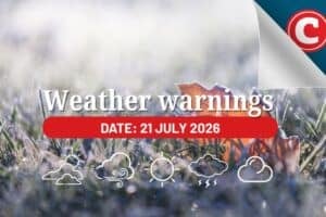
A level 2 warning for severe thunderstorms has been issued for Gauteng.

Picture: iStock
The South African Weather Service (SAWS) has issued a level 2 warning for severe thunderstorms in eastern Gauteng, eastern part of Free State, eastern Gauteng, Highveld and escarpment of Mpumalanga, and eastern and central parts of Limpopo on Saturday.
Localised flooding is expected in these areas, said the weather service.
An orange level 5 warning for disruptive rain leading to widespread flooding of roads and settlements, danger to life, and possible displacement of affected communities has been issued along the coast of KwaZulu-Natal (KZN).
The weather service has also issued a yellow level 2 warning for disruptive rain leading to localised flooding of susceptible formal/informal settlements and minor motor vehicle accidents due to wet slippery roads along the east coast of Eastern Cape, and interior of KZN.
“Light snowfalls on the high mountain peaks of the Eastern Cape and southern Drakensberg, with very cold and wet conditions with as well as Central Karoo in the Western Cape and southern parts of the Karoo Hoogland in Northern Cape are could result in isolated loss of vulnerable livestock.”
ALSO READ: Level 5 warning: Disruptive rain expected in Eastern Cape on Friday
Saturday’s weather forecast
Gauteng: Cloudy and cold with widespread showers and thundershowers. The expected UVB sunburn index: Low.
Mpumalanga: Cool in the Lowveld where it will be partly cloudy at first, otherwise cloudy and cold with widespread showers and thundershowers.
Limpopo: Warm in the extreme north-east, otherwise cloudy to partly cloudy and cool with scattered to widespread showers and thundershowers.
North West: Cloudy and cold to cool, with isolated to scattered showers and thundershowers.
Free State: Cloudy and cold, with isolated to scattered showers and thundershowers, but scattered to widespread over the east. Light snowfall is expected along the Lesotho Boarder.
Northern Cape: Partly cloudy and cool to col with isolated showers and thundershowers in the east. Morning fog patches expected along the coast. The wind along the coast will be moderate to fresh southerly to south-easterly.
Western Cape: Fine in places in the west otherwise cloudy to partly cloudy and cold to cool. The wind along the coast will be light to moderate southerly to south-easterly in the west, becoming south-westerly from the afternoon otherwise westerly to north-westerly. The expected UVB sunburn index: Moderate.
Western half of the Eastern Cape: Cloudy and cold, with scattered light showers and rain, but isolated in the south west. The wind along the coast will be light to moderate westerly.
Eastern half of the Eastern Cape: Cloudy and cold, with scattered showers and rain, but widespread in the east. It will be very cold over the high lying areas. The wind along the coast will be moderate southerly, but light westerly in the south at first.
KwaZulu-Natal: Cloudy and cool but cold in the west. Widespread showers and thundershowers are expected. The wind along the coast will be moderate south-westerly north of Durban in the morning, otherwise moderate to fresh southerly to south-easterly. The expected UVB sunburn index: Low.