Gauteng residents can expect isolated late afternoon and evening showers and thundershowers.

Picture: iStock
The South African Weather Service (SAWS) has issued a yellow level 2 warning for disruptive rain over the extreme north-eastern parts of the Beaufort West municipality of the Western Cape, the Kareeberg, Emthanjeni, Ubuntu and Umsobomvu municipalities of the Northern Cape and the Inxuba Yethemba, Enoch Mgijima, Blue Crane Route, Raymond Mhlaba, Makana, Ngqushwa and Ndlambe municipalities of the Eastern Cape.
“Localised damage to infrastructure, settlements (informal), property, vehicles, livelihood and livestock can be expected due to the combination of heavy downpours, strong damaging winds, excessive lightning and large amounts of small hail. Further, heavy downpours are expected to result in localised flooding of susceptible roads, low-lying areas and bridges and possibly cause minor vehicle accidents,” warned the weather service on Friday.
A yellow level 1 warning for waves resulting in localised difficulty in navigation for small vessels at sea has also issued between Cape Point and Alexander Bay.
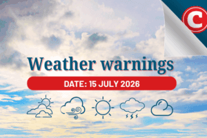
Saturday’s weather forecast
Gauteng: Partly cloudy and cool to warm with isolated late afternoon and evening showers and thundershowers. The expected UVB sunburn index: High
Mpumalanga: Cloudy in the east in the morning with fog patches along the escarpment, otherwise partly cloudy and cool with isolated showers and thundershowers except in the Lowveld where it will be warm.
Limpopo: Morning fog patches along the Limpopo Valley and in the south-western Bushveld, otherwise partly cloudy and warm with isolated showers and thundershowers except in the east.
North West: Morning fog patches in the extreme north-eastern parts, otherwise partly cloudy and cool to warm with isolated showers and thundershowers in the central and eastern parts.
Free State: Morning fog patches in the extreme east, otherwise partly cloudy and cool to warm, with isolated showers and thundershowers, but scattered along the Lesotho border as well as the southern parts.
Northern Cape: Partly cloudy and cool with isolated showers and thundershowers, except in the north where it will be warm, but cloudy over the central and south-eastern parts with scattered to widespread showers and thundershowers. The wind along the coast will be strong southerly.
Western Cape: Fine and cool to warm but cloudy and cool over the eastern and central parts with isolated showers and thundershowers but scattered in the north-east. The wind along the coast will be fresh to strong southerly to south-easterly but moderate easterly along the south coast becoming
fresh south-easterly in the afternoon. The expected UVB sunburn index: High.
Western half of the Eastern Cape: Cloudy and cold with scattered showers and thundershowers but widespread in the east. The wind along the coast will be light to moderate south-easterly, becoming north-easterly in the afternoon.
Eastern half of the Eastern Cape: Morning fog patches along the escarpment, otherwise cloudy and cold with widespread showers and thundershowers but scattered in the east. The wind along the coast will be moderate south-westerly.
ALSO READ: Isolated afternoon thundershowers expected in Gauteng on Friday
KwaZulu-Natal: Morning fog over the southern and extreme western interior, otherwise partly cloudy and cool but warm with isolated showers and thundershowers but scattered in the west and south. It will be warm in places in the east.
The wind along the coast will be moderate westerly to south-westerly becoming north-easterly in the north by afternoon, spreading to the south by evening. The expected UVB sunburn index: Low