Here's what weather you can expect on Thursday.

Traditional healers have been urged to be wary of flooding in KwaZulu-Natal. The overflowing Msunduzi River is pictured. Photo: Nwabiso Dlamini
South Africans should expect more rain, flooding and very hot and humid conditions on Thursday, the SA Weather Service has forecasted.
This after schools in KwaZulu-Natal closed early on Wednesday amid severe weather warnings. Joburg also experienced heavy rain and hail on Tuesday, with some roads being flooded.
On Wednesday the police issued safety tips for flooded areas.
ALSO READ: Expect heavy rains as level 5 weather warning issued
Weather warnings
The service issued a yellow level 2 warning for disruptive rainfall leading to localised flooding of susceptible formal/informal settlements as well as the low-lying roads and bridges in the morning over the Mopani and Vhembe districts Municipalities in Limpopo on Thursday.
A yellow level 1 warning for waves leading to difficulty in navigation at sea for small vessels and personal watercraft, was issued for areas between Cape Columbine and Cape Point in the morning.
Extremely high fire conditions are expected over the City of Cape Town, West Coast District and Drakenstein Municipality in the Western Cape as well as the western parts of the Northern Cape.
Advisories
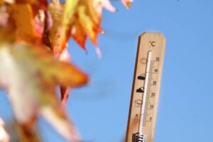
Extremely hot conditions with maximum temperatures exceeding 40 degrees are expected over the West Coast District in the Western Cape and southern coastal areas of the Namakwa District in the Northern Cape.
Uncomfortable, very hot and humid conditions are expected over the Western Cape and parts of Namakwa District in the Northern Cape until Friday.
Thursday’s weather forecast
Gauteng:
Cloudy and cool but warm in the north. with isolated showers and thundershowers are expected.
The expected UVB sunburn index: Extreme.
Mpumalanga:
Cloudy and cool but cold along the escarpment. Isolated morning showers and thundershowers are expected but scattered in the Lowveld.
Limpopo:
Morning for patches over the central parts, otherwise cloudy and cool to warm, with scattered morning showers and thundershowers but isolated in the south-west and south-central.
North West Province:
Partly cloudy and warm to hot, with isolated showers and thundershowers.
Free State:
Partly cloudy and warm, with isolated showers and thundershowers in the east.
Northern Cape:
Partly cloudy in the extreme north-west at first, otherwise fine and warm to hot but very hot to extremely hot in places in the west.
The wind along the coast will be Light to moderate southerly to south-easterly becoming fresh to strong from the afternoon.
Western Cape:
Partly cloudy over the eastern parts at first, otherwise fine and hot to very hot over the interior but extremely hot in the western interior.
The wind along the coast will be moderate to fresh southerly to south-easterly but easterly along the south coast and strong along the south-western coast.
The expected UVB sunburn index: Extreme.
Eastern Cape (western half):
Cloudy with isolated morning rain along the coast east of Gqeberha, otherwise partly cloudy, becoming fine and warm to hot.
The wind along the coast will be light to moderate easterly, becoming moderate to fresh south-easterly in the afternoon.
Eastern Cape (eastern half):
Partly cloudy and warm north of the escarpment, otherwise cloudy and cool with isolated showers and rain in places.
The wind along the coast will be light to moderate south-easterly
KwaZulu-Natal:
Partly cloudy and cool but warm in places in the east.
Scattered showers and thundershowers are expected along the coast and adjacent interior, otherwise isolated.
The wind along the coast will be moderate to fresh southerly to south-easterly.
The expected UVB sunburn index: Very high.