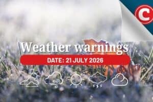
Get ready for diverse weather conditions across South Africa tomorrow – from damaging winds to icy roads.

Photo: iStock/Prostock-Studio
The SA Weather Service shared a diverse forecast for tomorrow, 22 July 2023.
We get a smattering of everything, from damaging winds to a sprinkling of snow. Here’s what you need to know.
Weather alerts, 22 July 2023
As the country braces for this mosaic of weather conditions, the public is advised to heed the warnings below and stay safe.
Wild winds
A yellow level 1 warning was issued for gale force winds which could potentially wreak havoc in the Eastern Cape.
The Joe Gqabi and Chris Hani District Municipalities, as well as the Raymond Mhlaba Local Municipality, should brace for disruptions to travel routes and possible damage to local settlements.
Snow and ice
A frosty weather alert was issued for the north-eastern high ground of the Eastern Cape.
Light snowfall and subsequent melt could result in treacherous icy roads, an essential factor for early morning commuters to bear in mind.
Weekend weather forecast
Rain and showers are expected over the western parts of the Western Cape on Saturday.
Isolated showers are expected over the Drakensberg mountains with morning showers in the north eastern parts of the country.
On Sunday, rain and showers are expected along the south and east coast of the country.
Provincial weather forecasts
Tomorrow’s weather patterns promise a diverse climate tapestry.
From frosty morning commutes to cloudy skies and showers, keep ahead of the weather with the latest forecast.
Here are the regional specifics:
Gauteng
Gauteng anticipates a cloudy start to the day, giving way to a partly cloudy and chilly ambiance as the day progresses.
The UVB sunburn index is predicted to be high, advising residents to take necessary precautions when stepping out.
Mpumalanga
The outlook for Mpumalanga is slightly more frigid, with a very cold to cool forecast.
The region expects morning drizzle along the escarpment, brightening up to a partly cloudy afternoon.
Limpopo
Limpopo’s weather pattern aligns with Mpumalanga’s, with a cold start and morning drizzle along the escarpment.
These conditions will gradually clear up to a partly cloudy afternoon.
North-West and Free State
The North-West Province and the Free State both look forward to a similar forecast.
Both regions will see a cloudy start, with the clouds making way for partly sunny skies in the afternoon, although the weather remains firmly on the cool side.
Northern Cape
In the Northern Cape, the day will begin with partly cloudy skies in the east. However, the rest of the region can expect clear skies and a cool temperature, dipping to cold in the south.
Coastal winds will be light and primarily southerly to south-westerly.
Western Cape
In the Western Cape, the weather will start off fine and transition from cool to cold, with the south-western part becoming partly cloudy.
The extreme south-west will see thicker clouds with showers and rain from the afternoon.
Coastal winds will range from light to moderate, coming from a north-westerly direction and shifting to west to south-westerly later in the day.
Eastern Cape
For the western half of the Eastern Cape, a cloudy morning will be followed by fine and cool weather.
The eastern half, however, will begin partly cloudy, transitioning to fine and cool conditions, with a warmer feel along the coast.
In contrast, morning drizzle and light snow can be expected north of the escarpment.
KwaZulu-Natal
Lastly, KwaZulu-Natal is set for a partly cloudy morning, accompanied by fog over the western interior.
The rest of the day will be fine and cool, with moderate to fresh northerly to north-easterly coastal winds.