Here's what weather you can expect on Wednesday.

Picture: iStock
Most of South Africa should experience warmer weather on Wednesday, while eight provinces can expect thundershowers.
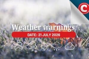
Weather warnings
In its regional forecast, the SA Weather Service issued a yellow level 2 warning for severe thunderstorms with heavy downpours, and strong damaging winds, will result in localised flooding of susceptible roads, low-lying areas and bridges over the southern parts of the Namakwa in the Northern Cape, central Karoo in the western Cape and western parts of KZN.
A yellow level 1 warning for disruptive rain leading to localised flooding of susceptible settlements and roads, low-lying areas and bridges, was issued for places over the northeastern parts of the Eastern Cape.
Advisories
There are no advisories this time.
Provincial weather forecast
Gauteng:
Cloudy in the morning, otherwise partly cloudy and warm with isolated thunderstorms.
The expected UVB sunburn index: Extreme.
Mpumalanga:
Cloudy with morning drizzle along the escarpment, otherwise partly cloudy and cool to warm with isolated afternoon showers and thundershowers except in the Lowveld.
Limpopo:
Cloudy with drizzle along the escarpment in the morning, otherwise partly cloudy and warm to hot.
North West Province:
Partly cloudy and warm, with isolated showers and thundershowers, except in the north-east
Free State:
Partly cloudy and warm, with isolated showers and thundershowers, but scattered in the west.
Northern Cape:
Morning fog patches in the extreme west, otherwise partly cloudy and cool to warm with isolated to scattered showers and thundershowers over the central and eastern parts.
The wind along the coast will be moderate to fresh southerly to south-easterly reaching strong at times in places.
Western Cape:
Cloudy with isolated rain and showers along the south coast until the afternoon, otherwise partly cloudy and cool to warm with isolated to scattered showers and thundershowers expected in places over the eastern parts from the afternoon.
The wind along the coast will be light and variable in the eastern parts of the south coast at first, otherwise moderate to fresh southerly to south-easterly, reaching strong along the SW coast.
It will reach strong at times along the south and west coast. The expected UVB sunburn index: Very high.
Eastern Cape (western half):
Cloudy and cool with scattered showers and thundershowers.
The wind along the coast will be Light southwesterly, becoming easterly in the afternoon.
Eastern Cape (eastern half):
Cloudy and cool with showers and thundershowers but widespread in the east.
The wind along the coast will be Light southwesterly becoming south-easterly south of Coffee Bay towards the evening.
KwaZulu-Natal:
Morning fog in places over the interior, otherwise partly cloudy becoming cloudy and cool to warm with isolated to scattered showers and thundershowers but widespread in the south.
The wind along the coast will be the wind along the coast will be light to moderate northerly to north-easterly but fresh in places, becoming light south-westerly in the extreme south.
The expected UVB sunburn index: High.