Find out what the latest weather forecast from the SA Weather Service means for your region.

Picture: Canva
The South African Weather Service (Saws) has released its latest weather forecast for Tuesday, 26 March.
The weather service has warned of severe thunderstorms resulting in localised flooding of susceptible roads, low-lying areas, and bridges in parts of the Northern Cape and Western Cape. Here’s what you need to know.
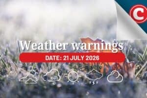
Weather warnings, 26 March
Weather warnings
The weather service has issued a yellow level 2 warning for severe thunderstorms resulting in localised flooding of susceptible roads, low-lying areas, and bridges over the central parts of the Northern Cape and the north-eastern parts of the Western Cape.
Provincial weather forecast
Here’s what to expect in your province on Tuesday, 26 March
Gauteng:
Residents of Gauteng can anticipate cloudy and cool but warm conditions in the north. It will become party-cloudy in the afternoon.
Mpumalanga:
Mpumalanga residents can expect morning fog patches along the escarpment and southern highveld; otherwise, it will be cloudy and cool weather, but warm in the lowveld. Isolated morning showers are expected in the east.
Limpopo:
The day will be cloudy and cool to warm, with isolated showers except in the west scattered over the north-eastern parts.
North-West province:
A day of cloudy conditions in the east at first awaits North West residents but otherwise it will be partly cloudy and warm to hot with isolated showers and thundershowers in the west and south.
Free State:
Residents of the Free State will see cloudy weather with morning fog patches in the east; otherwise, it will be partly cloudy and warm with isolated showers and thundershowers scattered in the extreme south.
Northern Cape:
There will be partly cloudy, windy, and warm to hot weather with isolated to scattered showers and thundershowers, except along the coast and adjacent interior, where it will be cool.
Western Cape:
Western Cape residents can expect cloudy conditions in the south; otherwise, it will be partly cloudy and cool to warm, with isolated showers and thundershowers over the eastern parts but scattered in the extreme east. Morning fog patches are expected over the central interior.
The region’s expected UVB sunburn index is “very high.”
Residents should take the necessary precautions against prolonged sun exposure.
Eastern Cape (western half):
Cloudy and cool weather is expected along the coast and adjacent interior; otherwise, it will be partly cloudy and warm with scattered showers and thundershowers.
Eastern Cape (eastern half):
Residents can look forward to partly cloudy and warm conditions with scattered showers and thundershowers, but isolated along the Wild Coast.
KwaZulu-Natal:
Residents of KwaZulu-Natal can look forward to partly cloudy and warm but cool weather in places in the north with isolated showers and thundershowers except in the central interior, scattered in the extreme south-west.
The region’s expected UVB sunburn index is “very high.”
Residents should take the necessary precautions against prolonged sun exposure.