A yellow level 2 warning for disruptive rain has been issued in places over Mpumalanga.

Picture: iStock
The South African Weather Service (SAWS) has issued a yellow level 2 warning for severe thunderstorms, leading strong winds, hail and heavy downpours over the extreme eastern parts of North West and Gauteng.
A yellow level 2 warning for disruptive rain has been issued in places over Mpumalanga.
According to the weather service, much of the highveld can expect maximum temperatures in the low teens on Monday and Tuesday, with Johannesburg likely to peak at only about 11 to 12°C.
“Some high-lying areas may even see single digit maximum temperatures,” it warned.
Extremely high fire danger conditions are expected over Kamiesberg Northern Cape, Matzikama municipalities in the Western Cape.
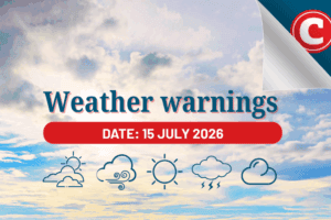
Tuesday’s weather forecast
1. Gauteng: Expect cloudy and cold weather in Gauteng, with scattered showers and thundershowers. The UVB sunburn index is high.
2. Mpumalanga: Morning fog patches are likely over the escarpment, giving way to cloudy and cold conditions. Widespread showers and thundershowers are expected, especially along the escarpment, where it will be very cold.
3. Limpopo: Limpopo will experience morning fog patches over the escarpment. The weather will be cloudy and cold to cool, with isolated to scattered showers and thundershowers.
4. North-West Province: Cloudy and cold to cool conditions are forecasted, with scattered showers and thundershowers. The west will see isolated showers and warmer temperatures.
5. Free State: The Free State will have partly cloudy to cloudy and cold to cool weather. Isolated showers and thundershowers are expected, with more scattered showers in the east.
6. Northern Cape: Partly cloudy and cool to warm weather is on the horizon, with isolated showers and thundershowers. The west, however, will enjoy fine weather. Coastal areas will experience strong winds.
7. Western Cape: The Western Cape will have partly cloudy and warm to hot conditions. Along the south coast, it will be cooler. Coastal areas will experience moderate to strong winds. The UVB sunburn index is very high.
ALSO READ: Rugby World Cup celebrations in the cold? SAWS warns of wet weather conditions
8. Western Half of the Eastern Cape: Expect morning fog in some interior areas, but otherwise, the weather will be fine and cool. Coastal areas will experience strong easterly winds.
9. Eastern Half of the Eastern Cape: There may be morning fog in some interior areas. The weather will be partly cloudy and cold, with isolated showers and thundershowers along the coast. Coastal winds will be light to moderate north-easterly.
10. KwaZulu-Natal: Morning fog is expected over the interior, with cloudy and cool (even cold in the west) conditions. Scattered showers and rain are expected, especially in the west and the south-west. Coastal winds will be moderate to fresh, changing direction in the afternoon. The UVB sunburn index is moderate.