Saws predicts unsettled conditions with heavy rain, thunderstorms, and potential flooding as a cut-off low sweeps the country.

Picture: iStock
The South African Weather Service (Saws) predicts cooler and more unsettled weather over the next several days for a large portion of South Africa.
This comes after recent prolonged heatwaves and below-average rainfall over South Africa’s interior.
Saws said on Thursday that an intense low-pressure system, known as a cut-off low, is forecasted to bring widespread showers and thunderstorms to many parts of the country this weekend until early next week (6 to 9 April).
Large weather systems known as cut-off lows are known to cause extensive flooding, as seen by past events such as the floods in KwaZulu-Natal in 2022 and the Laingsburg flooding in 1981.
Damaging winds, severe thunderstorms and snow possible
According to the weather service, these weather systems can bring damaging winds, severe thunderstorms, and even snow, depending on the season in which they develop, and they are most frequent during autumn and spring.
“Tropical moisture has been transported from our neighbouring countries to the central and eastern interior of South Africa since yesterday (Wednesday). This will result in scattered rainfall to continue today (Thursday) and Friday, which will spread to the southern parts of the Western Cape and parts of the Eastern Cape tonight into Friday. Cooler temperatures are forecasted for the southern and eastern parts of the country from tomorrow (Friday),” Saws said.
ALSO READ: Disruptive rain expected in parts of KZN, Limpopo and Mpumalanga
After this, an intense cut-off low is expected to develop along the west coast of the country from Saturday afternoon.
It will then move over the Northern Cape on Sunday, reach the interior of the Western Cape on Monday, and exit along the southern coast of the Western Cape on Tuesday.
Widespread showers and thundershowers are expected to develop over much of the country on Saturday and will continue until at least Tuesday; thereafter, calm and clear weather conditions will return to many areas.
Snow?
According to SnowReportSA, the cut-off low may lead to snow falling on peaks of Lesotho and other elevated parts of the Drakensberg mountains.
It added that though snow is possible, the forecast could change as the data has been up and down over the last few days.
Heavy rain may lead to flooding
Saws said persistent rain and thundershowers may lead to flooding over the central and eastern parts of the country, particularly from Sunday into Monday, while severe thunderstorms with heavy rainfall and large amounts of small hail are possible over the western interior on Sunday into Monday.
ALSO READ: Level 2 warning: Heavy rain, severe thunderstorms expected in two provinces
There is also an indication of heavy rainfall over parts of the Overberg and south-west coast of the Western Cape on Monday into Tuesday as the cut-off low exits along the southern coast of the Western Cape.
Cool to cold maximum temperatures are also expected across parts of the Western Cape, Eastern Cape, and KwaZulu-Natal from Saturday, which will spread to the remainder of the country on Sunday into Monday.
Day-time temperatures are expected to be in the high teens and low 20s across most parts and will even go down to the low teens over the high-lying areas of the Eastern Cape and KwaZulu-Natal.
Uncertainty remains
“There remains uncertainty among Numeric Weather Prediction (NWP) models regarding the intensity and future movement of the system,” Saws said.
“This uncertainty could lead to changes in rainfall amounts and distribution, and the South African Weather Service will therefore provide regular updates to the public and disaster management on expected weather conditions and potential impact-based warnings.”
ALSO READ: Gauteng bad weather: Warning of more rains in the coming days
Meanwhile, Saws has released its latest weather forecast for Friday, 5 April 2024.
The weather service has warned of wind and waves leading to difficulty in navigation at sea and a cut-off low accompanied by an intense surface high pressure system in the Cape Provinces from Saturday until Monday. Here’s what you need to know.
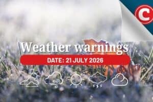
Weather warnings, 5 April
Weather warnings
Saws has issued a yellow level-1 warning for wind and waves leading to difficulty in navigation at sea between Saldanha Bay and Cape Agulhas from Friday until Saturday.
Advisories
A cut-off low accompanied by an intense surface high pressure system is expected to affect the Cape provinces from Saturday until Monday.
Saws has advised the public and small stock farmers that these systems will result in disruptive rainfall, flooding, and very cold conditions in places over the Western Cape, southern parts of the Namakwa in the Northern Cape, and northern parts of the Eastern Cape. Damaging wind and waves are expected along the coastal areas of the Western Cape.
Provincial weather forecast
Here’s what to expect in your province on Friday, 5 April
Gauteng:
Residents of Gauteng can anticipate cloudy and warm conditions with scattered showers and thundershowers in the afternoon.
The region’s expected UVB sunburn index is “high.”
Residents should take the necessary precautions against prolonged sun exposure.
Mpumalanga:
Mpumalanga residents can expect cloudy and cool to warm weather with scattered showers and thundershowers but isolated in the extreme north-east. It will be hot in the Lowveld.
Limpopo:
The day will be cloudy and warm to hot, with isolated showers and thundershowers scattered in the western bushveld.
North-West province:
A day of partly cloudy and warm conditions awaits North West residents, with isolated showers and thundershowers scattered over the eastern parts.
Free State:
Residents of the Free State will see morning fog patches over the east at first; otherwise, it will be partly cloudy and cool with isolated showers and thundershowers scattered over the east.
Northern Cape:
There will be cloudy conditions in the morning in the west, becoming fine and cool; otherwise, it will be partly cloudy and warm to hot, with isolated showers and thundershowers over the eastern parts.
Western Cape:
Western Cape residents can expect partly cloudy and cool weather with isolated showers and rain along the south coast and eastern interior. It will be fine in the west in the afternoon, where it will be warm along the coast.
The region’s expected UVB sunburn index is “very high”. Residents should take the necessary precautions against prolonged sun exposure.
Eastern Cape (western half):
Cloudy and cold to cool conditions are expected, with isolated showers and rain scattered along the coast.
Eastern Cape (eastern half):
Residents can look forward to cloudy and cool-to-cold weather with isolated showers and rain scattered along the coast. Isolated thunderstorms can be expected over the interior.
KwaZulu-Natal:
Residents of KwaZulu-Natal can look forward to partly cloudy and cool to warm conditions, becoming cloudy in the afternoon with scattered showers and thundershowers.